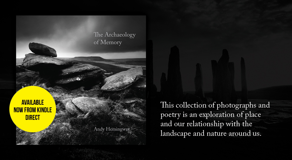
My first book is a collection of images and poetry, gathered over a number of years in Northern Britain, influenced by the genius loci of these places, their history, folklore and their nature. The Archaeology of Memory is an exploration of place and our relationship with the landscape and nature around us.
Alignments of standing stones, mythical beasts, kings and giants engaged in dimly remembered battles, the landscape of the British Isles is filled with memories. Generation after generation have brought their languages and stories with them. Words from across the ages melt together and form place names, myths and ghosts. Stories seep into the land, leaving an indelible stain.
An’ siccan pranks by the haunted thorn They hae the po’er to play, That mortal man was never born Could see , an’ live till day!
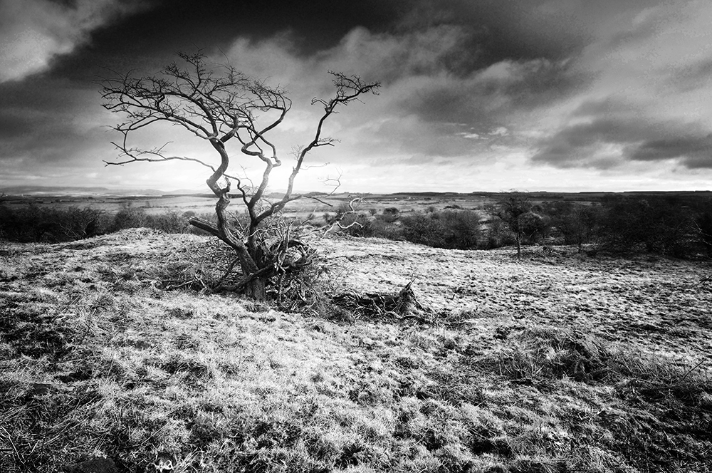
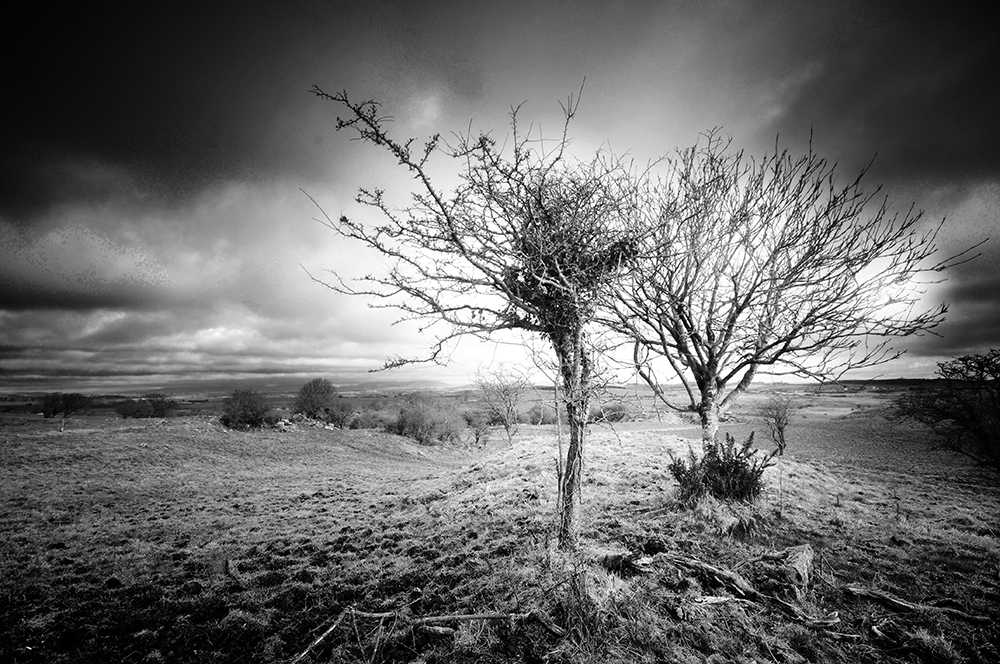
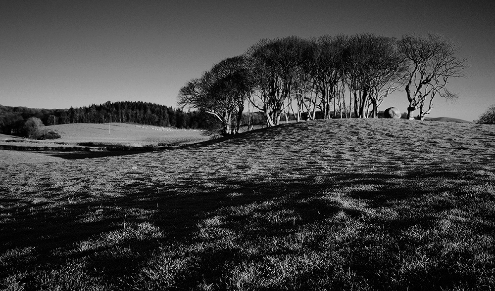
A twisted hawthorn tree at Man Wrap.
It is the days when the wind drops, you really notice the difference. Snow rarely falls on the fringes of the Machars peninsula, but a cold, cutting wind is an almost constant companion during winters in these lands. Contorting the bare skeletons of stunted trees, into horrific, twisted creatures.
The Legend O’ Kirkmaiden tells that on such a night, with a storm raging around the ancient Fell of Barhullion, a merry gathering took place at the nearby old House of Moure, the original home of the Maxwells of Monreith. As the evening wore on and the guests partook freely of the hospitalities, talk turned to the supernatural. Bravado flowed as freely as the drink by the warmth of the fire, as the guests told tales of bravery and indifference of all things dark and uncanny, until a young man declared he would ride to the church of Kirkmaiden and return with its bible, as proof he’d been there1.
Despite dire warnings from ‘Jock of the second sight’ to avoid the haunted hawthorn tree, the foolhardy young McCulloch, full of drink and valour, replied that he’d not only pass by the tree, but also cross the witches lair2 and rode off into the teeth of the tempestuous night.
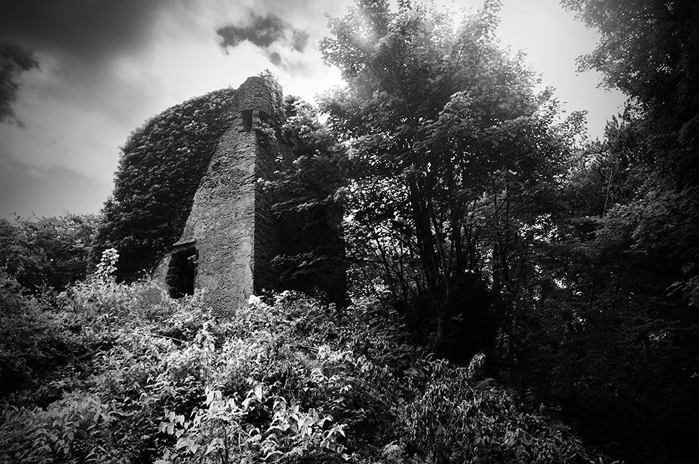
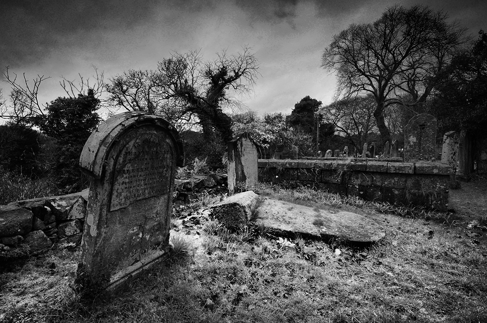
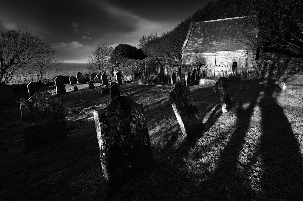
The ruins of Kirkmaiden church, beside Monreith Bay.
As the night wore on and despite Kirkmaiden only being a short ride away, McCulloch did not return. Once daylight broke, a search party set out and found his body and that of his horse laying in a bleak spot, with both of their entrails entwined around the haunted hawthorn. He had reached the church and was returning to the House of Moure with the bible.
M’Culloch’s bluidy corpse they saw, In’ the licht o’ that awfu’ morn, Wrapp’d roun’ in the thorny branches a’ , An’ the heart frae the body torn!
What foul fiends’ wark the youth did dree That nicht, there’s nane can say, But weel kent is that hawthorn tree Ca’d ” Man-wrap” to this day.
A twisted hawthorn tree at Man Wrap.
It is difficult to ascertain when the story is set. Kirkmaiden merged with the parish of Glasserton, sometime before Andrew Symson wrote his ‘A Large Description of Galloway’ in the 1680s, in which he describes the church as ruinous. The original House of Moure came into the possession of the Maxwell family circa 1450, via the marriage of Edward Maxwell to an heiress of the de Mundeville family. It was replaced by the tower house now known as Dowies in the late 16th/early 17th century, but the name transferred to the new building3. This in turn was abandoned in favour of Myrton Castle when William Maxwell bought it from the McCullochs in 1684. It seems almost certain the story would be set well before this date.
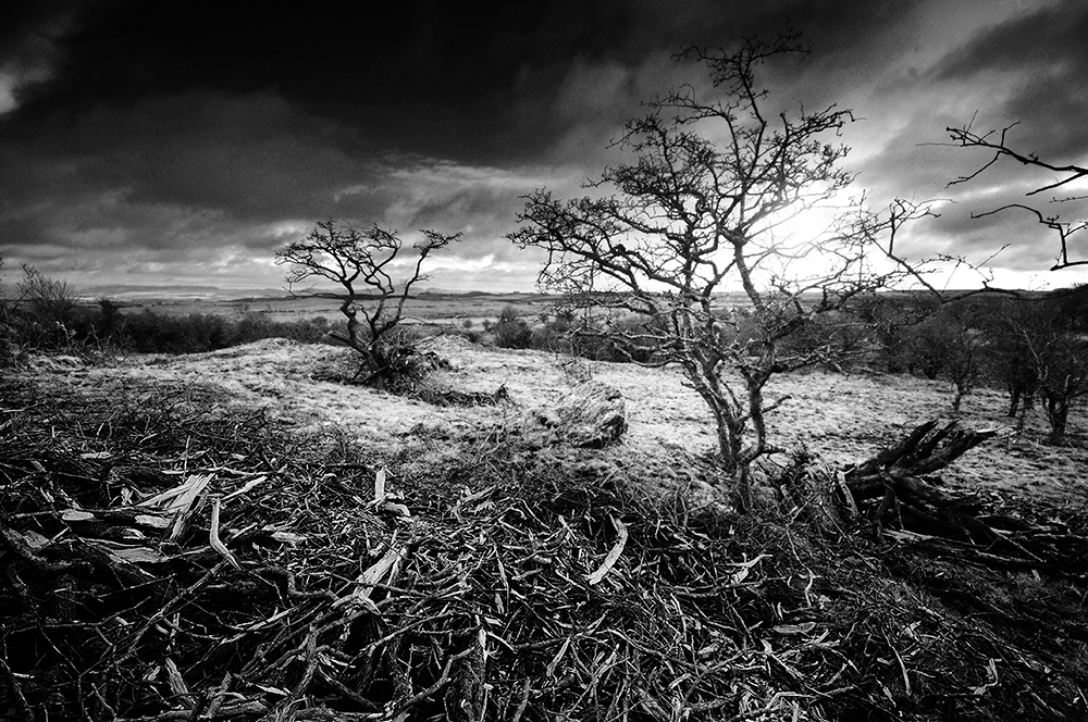
Man Wrap is a bleak area of rough, stony ground beneath the eastern side of the Fell of Barhullion, populated by a number of twisted hawthorn trees. The name survived long enough to be included on the first Ordinance Survey map of the area in the 1840s.
Today, little has changed and it is obvious few visitors tread here. On a gloomy winter afternoon, you stumble on the uneven, frozen ground in the half light. Gnarled branches grab at your coat and scratch your face. The wind grows colder as the sun sets and the place manifests an atmosphere of seething menace. Wind felled hawthorn trees lay scattered, not just blown over, but smashed into pieces, utterly destroyed. Visitors are not welcome here, once the darkness rises.
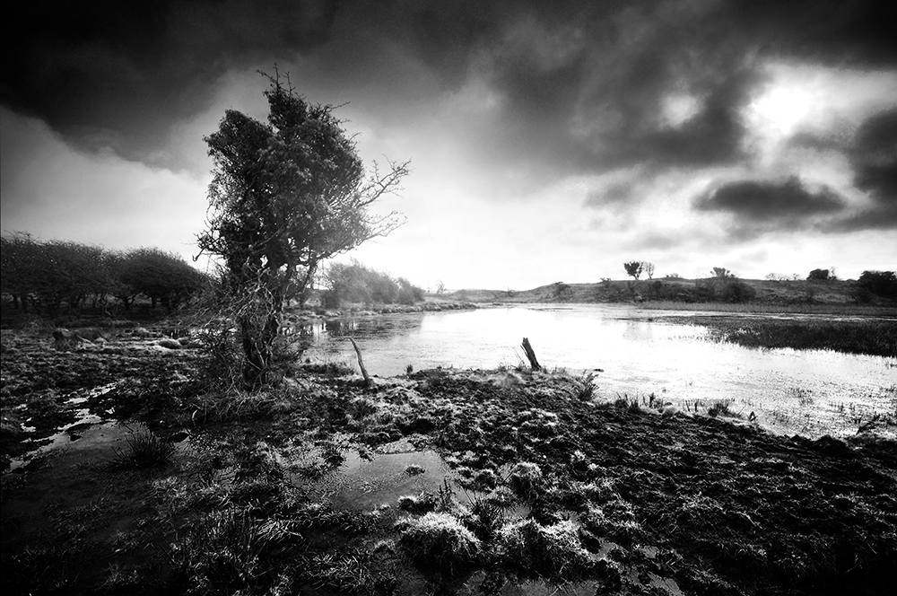
Tree beside the lochan at Man Wrap.Smashed remains of a fallen hawthorn at Man Wrap.
Sources
1. Maxwell Wood, J (1911) Witchcraft and Superstitious Record in the South-Western District of Scotland, J Maxwell & Son P. 256.
2. M’Lachlan Harper, M (1889) The Bards of Galloway, Thomas Fraser P. 16 A Legend O’ Kirkmaiden, David M’Kie.
3. Reid, R C. (1948b) ‘Dowies’, Trans Dumfriesshire Galloway Natur Hist Antiq Soc, 3rd, vol. 25, 1946-7. P. 36-8
The wran, the wran, the king of all birds, St Stephens’s Day was caught in the furze. Up with the kettle and down with the pan, Give us a penny to bury the wran.1
The Wren’s Egg, with standing stones and ‘nest’ behind.
It’s a freezing cold early January morning, still dark at 7.30am. Under a blanket of stars, I can hear the sharp crunch of frosty grass under my feet. The first hints of dawn begin to show on the south eastern horizon, a sliver of deep pink above which hangs the crescent moon and the bright pinprick of light that is Venus.
I’m walking towards the Wren’s Egg and Nest, taking care to walk a wide arc around the edge of the field, to avoid leaving my footprints in shot on the frosty grass. I reach the tree covered clump next to the stones, just as a blackbird strikes up its dawn chorus in the branches above. I visited just two days before for sunset, but wanted to photograph a sunrise here too.
Blairbuy is close to Monreith, west of the Fell of Barhulion, the Wren’s Egg is a curious place. A large granite boulder sat at the end of a low natural ridge, dumped some fifteen thousand years ago by retreating glaciers, while creating the beautifully undulating Machars landscape. The name ‘Blairbuy’ is derived from the Scottish Gaelic ‘Blar Buidhe’, meaning the golden or yellow field.
The Wren’s Egg and Nest with standing stones to the right.
The erratic appears to have held some significance during the late Neolithic or early Bronze Age, as an unknown number of standing stones were placed close to it. Local rumour tells the boulder was at the centre of a circle, made of two concentric rings of which only two small stones remain. The others having been cleared for use as gateposts or broken up.
“On the farm of Blairboy some fifty years ago, was a double circle of large stones, with one flattopped stone in the centre. All have been long removed, except the centre stone, and one stone of each of the circles”2.
It is true there are a few likely looking stones in the drystone dykes around the field, but excavations during the 1970s found this to be unlikely3. The possibility remains that there were more than the two remaining stones in alignment with the boulder.
A distant view of the Wren’s Egg and Nest.
In 2012, ploughing led to the discovery of three stone cists nearby, in the north western corner of the field. When excavated, one contained the early Bronze Age burial of a juvenile, while the other two had not been occupied4. The stones that formed the cist now lean against the field wall to the east of the stones.
The area is also well known for its cup and ring marked rocks, seemingly centred around the foot of the Fell of Barhullion, the highest hill in this area. Rising out of the undulating landscape, topped by earthwork ditches, it seems highly likely that the hill is at the centre of this prehistoric landscape.
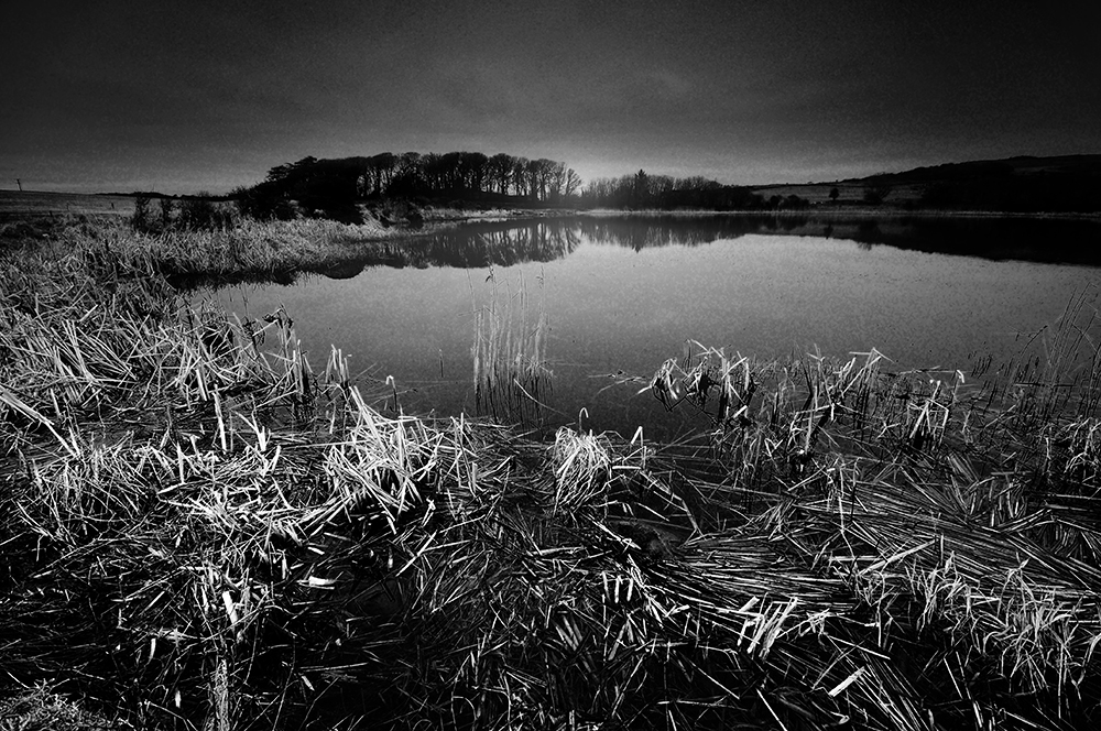
Sunrise approaches. As I wait for the light to reach the Wren’s Egg, I notice a finger of light creeping across the field opposite, towards another pair of standing stones about 400m away, known as the Blairbuy Stones. A little loch lies close by, downhill from the stones and it would be interesting to consider if this was in some way connected to the other sites, given the sacred nature of water in prehistory.
The Blairbuy Stones at Sunrise.Blairbuy Loch.
The pair of stones at the Wren’s Egg point south west, said by Alexander Thom to align with the mid-winter sunset over the rocky island of Big Scare in Luce Bay, but is only visible when you stand on the egg. The two short stones don’t align correctly with the boulder, which puzzles me, until I find the boulder was moved some time ago, by a farmer trying to clear the field. His attempt failed, but moved the boulder just enough to take it out of alignment5.
The curious name ‘Wren’s Egg and Nest’ may reference the folk custom of the hunting of the wren. Widespread in Ireland, Wren Day was practiced on St Stephen’s Day (26th December) and involved gangs of ‘Wren Boys’ in fancy dress hunting a wren, which would often be killed, tied to a pole decorated with oak leaves and mistletoe and paraded around the village, collecting money for its burial.
The folklore of the wren entwines both Pagan and Christian symbolism. Its Gaelic name is ‘Dreolín’ meaning ‘Druid Bird’ and is a symbol of winter and the old year. The killing of the wren may symbolise the death of the old year, the death of winter, or possibly as a surrogate for the ancient Celtic practise of the yearly sacrifice of a king. The wren is after all, known as the king of all birds. It was said to have betrayed the hiding place of St Stephen, who was stoned to death, becoming the first Christian martyr.
Other variations of Wren Day took place in England, Wales and the Isle of Man around mid-winter, with variations on Christmas Day, New Year’s Day or Twelfth Night. A version of this custom was recorded as being practised in the Galloway parish of Kirkmaiden, called ‘The Deckan’ O’ the Wren’ and usually took place on New Year’s morning, when gangs of boys would search for wrens. Upon catching one, its neck and legs would be adorned with ribbons and the bird then set free6.
Another possibility could be a satirical reference to a condition in the lease of the farm, insisted upon by the landowner William Maxwell during the 1840s7, that the stone should not be moved. Disturbing a wren’s nest was considered to be bad luck.
The Wren’s Egg and standing stones at sunrise.A view across the fields from the ‘nest’.
The sun finally creeps across the field and reaches the Wren’s Egg. It is one of those metallic winter mornings, as bright and sharp as newly burnished steel blade. I stand in the frosty grass and it all seems to make sense. This is a place of winter, a place of death and rebirth. The death of the old year and rebirth of the land. The alignment towards the mid-winter sunset, the nearby loch and standing stones, the significance of the wren as a symbol of winter and the old year, the nearby burial cists, all seem to add weight to this. On a cold, bright and frosty winter morning, it isn’t difficult to imagine the mid-winter rituals that may have taken place here.
Sources
1. Irish folk song.
2. P.H. M’Kerlie. History of the Lands and Their Owners in Galloway. 1870 Vol 1 p. 505.
3. L. Masters. Excavations at the Wren’s Egg, Port William, Wigtown District. DGNHAS Transactions and Journal of Proceedings 1976-77 Third Series Volume 52 p.28-43.
4. W. Bailie. Preparing for Death: Excavations at Blairbuy, Dumfries and Galloway in 2012. GUARD Archaeology Ltd 2013.
6. Masters 1976-77. Unfortunately, the reference doesn’t record if this is the parish of Kirkmaiden in which the Wren’s Egg is located, or the other of the same name on the Rhins peninsula.
7. J. Murray. The Stone Circles of Wigtownshire. DGNHAS Transactions and Journal of Proceedings 1981 Third Series Volume 56 p.18-30.
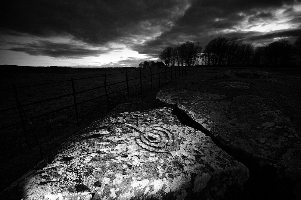
Drumtrodden Rock Art in the cold, winter gloaming.
It’s a bitterly cold afternoon in early December, the sun is lowering towards the horizon. I’m stood by a small outcrop of rock at Drumtroddan, setting up my camera on its tripod as I’m waiting for the sun to set, with nothing but a herd of sheep for company.
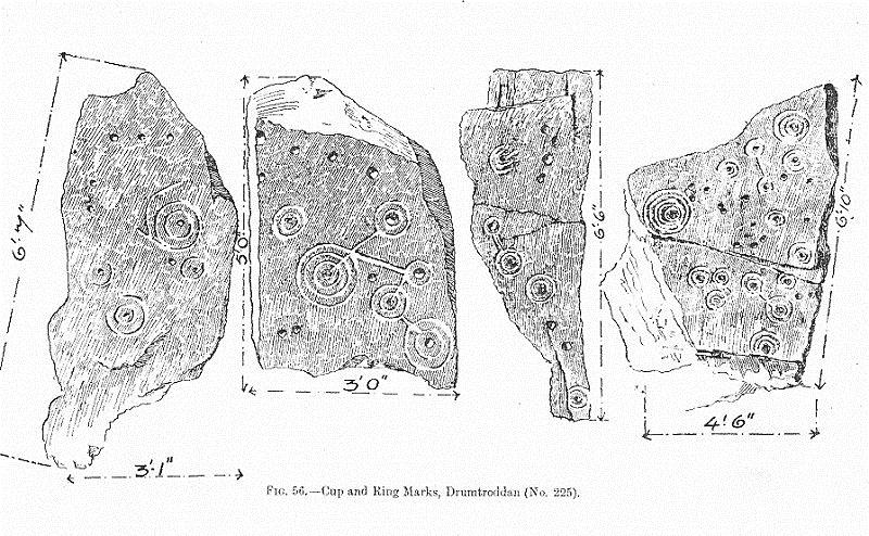
This corner of Drumtroddan Farm is home to several panels of prehistoric rock art. Carved into rocks by pecking with a stone tool, often on the horizontal surfaces of outcrops and land-fast boulders, large concentrations of them can be found in groups mostly around northern England and in Scotland. They commonly are composed of a central depression, sometimes surrounded by a ring or several concentric rings, sometimes with accompanying grooves. Known as cup and ring markings, limitless variations can be found on this theme, often with regional variations regarding the use of concentric rings, meandering grooves and clusters of cup marks.
The mystery is, unlike other prehistoric features, it is very hard to decipher their meaning. There are no associated organic remains to help date them and no historic references that mention them. The only clues we have are their associations with datable monuments, such as the rock art panel, levered from the bedrock and repurposed as a capstone in the Bronze Age Nether Largie North cairn, in Kilmartin. The carvings show signs of weathering, meaning they had sat in their original position for quite some time, before inclusion in the cairn. It seems they still had some meaning to the cairn builders of Kilmartin, despite already being of some considerable age.
Another clue can be their position in the landscape. Often on the slopes of hills, very rarely on the top, with wide ranging views, perhaps they mark out a special space, route or view of significant landscape features. The rock art included in the magnificent enclosure of Woofa Bank on Ilkley Moor, lies between two springheads. It is conjectured that in prehistory, they may have been painted, or designs replicated on wood and fabrics. Over 100 theories have been put forward about what rock art could mean, from the banal to the mundane, but the truth is we will probably never decipher their real meaning, being long lost in the mists of time.
Drumtroddan Standing Stones are just a short distance to the south of the rock art panels and beyond them, I can see the hill tops of the Isle of Man. I watch the last flecks of light strike the Galloway Hills to the east, as the sun slips below the clouds, a deep orange glare behind the small copse of trees to the west. Perhaps it is this view of the hills that have some relevance to the position of the carvings, or that the outcrop points south west, towards the mid-winter sunset.
The sky slowly darkens as light flees over the western horizon, soon it is dark enough for the lights to work on the rock art. In daylight, just a few rings and cup-like depressions are visible, but once a low, raking light is placed by the rock, the carvings spring to life. Concentric rings and grooves, virtually invisible by day cover the surface of the outcrops. It is one of those ‘wow!’ moments.
As the darkness grows, it gets colder, dropping below freezing. After just over half an hour of trying different compositions and lighting angles, I find the cold is affecting my fingers to the point it is difficult to operate the camera, despite double layers of gloves. Crunching back across the thin, frozen layer on top of the mud, I make my way home.
Illustrations of Drumtroddan Rock Art panels, from 1912.
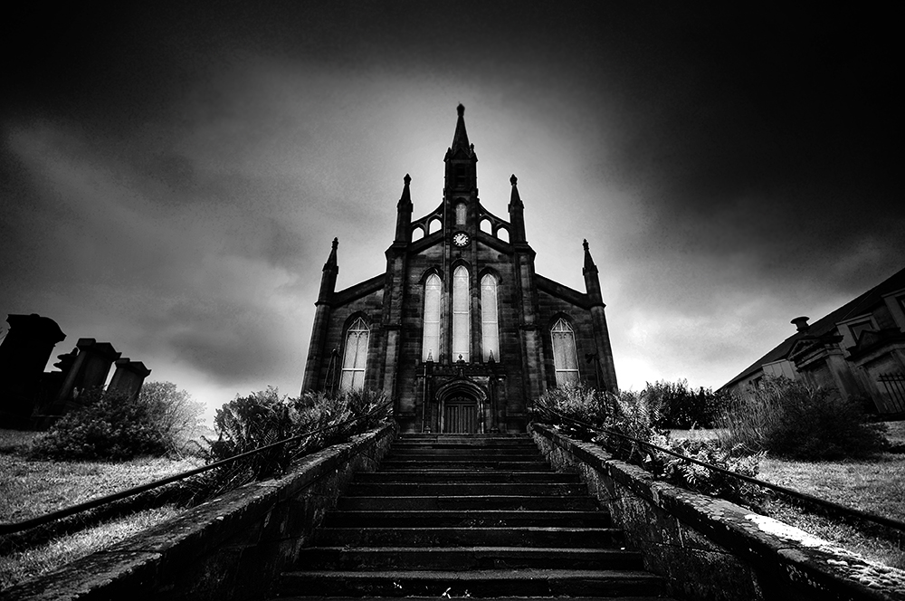
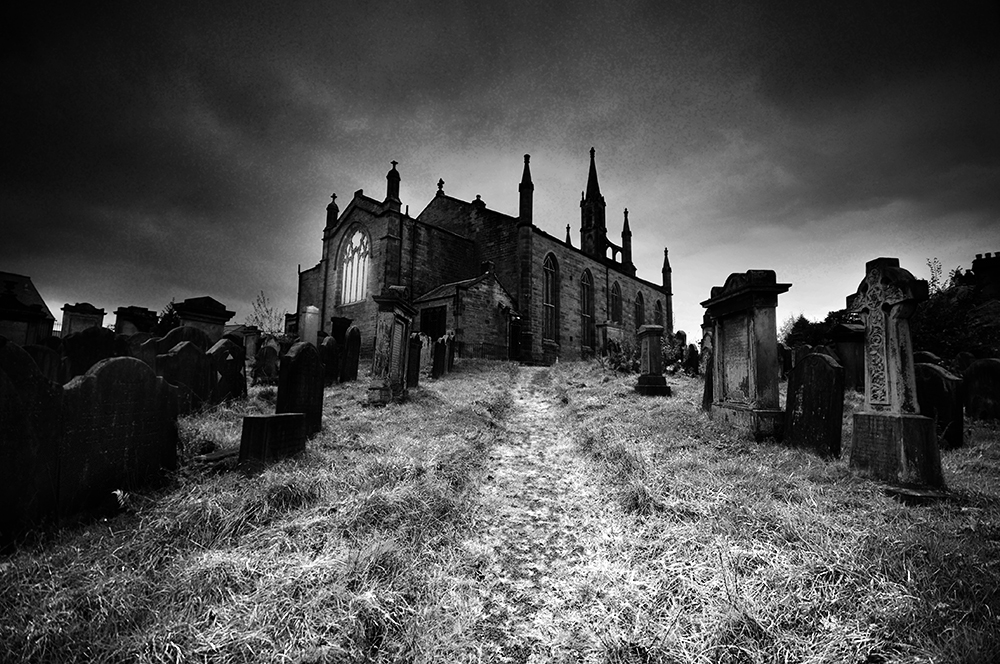
On a small hill, set back a little from the busy road at the end of English Street, stands an early 19th century gothic church. It would be easy to walk past the gateway and stone steps, unsuspecting of the dark history connected to this corner of Dumfries. For this little hill, now populated by the church and peaceful, if not slightly neglected grave yard, was once a place of execution. Only a small collection of stones, cemented together in front of the church hint at its past.
Across town, at a bus stop outside Greggs, is the place where Robert the Bruce slayed John Comyn before the altar at Greyfriars Church, on 10th February 1306. His supporters Roger de Kirkpatrick and John Lindsay went back and made ‘siccar’ (sure) that Comyn was finished. Rushing to his nephew’s aid, Robert Comyn was killed by a sword blow to the head, delivered by Bruce’s brother-in-law, Christopher Seton.
Bruce was hurriedly crowned King of Scotland at Scone on 25th March 1306, but the disastrous defeat at the Battle of Methven on 19th June 1306, where again Bruce was saved by Seton, led to his flight to safety with a small band of loyal followers.
“The king was thrice unhorsed, and once so nearly taken, that the captor, Sir Philip De Mowbray, called aloud that he had the new-made king, when Sir Christopher Seton felled Mowbray to the earth and rescued his master.”1
Seton was captured at Loch Doon in Ayrshire, after he was betrayed to the English by Gilbert de Carrick and taken to Dumfries, where he was tried and executed on 14th August 1306. On the hill top now occupied by St Mary’s Church, he was hung, drawn and beheaded.
“The dread apparatus of death was erected on a high natural eminence, situated beyond the walls, on the north-east of the Burgh, so that the inhabitants might have an opportunity of seeing how the usurper rewarded what his judges called rebellion, and of profiting by the spectacle. The Dumfriesians of that day were unfortunately too much accustomed to such sights; but they would be dreadfully shocked, nevertheless, by these executions – one of the sufferers being none other than Sir Christopher Seton, the brother-in-law of their King, a most valiant warrior, who at the battle of Methven had rescued Bruce, by felling his captor, Sir Philip de Mowbray, to the ground. He was accused of treason in general, and more especially of having been present at the slaughter of Comyn.”2
This seems to have been the usual place of execution at the time.
“It was the Tyburn of Dumfries ; and here also, as tainted and polluted ground, all suicides were buried. When the excavations were being made for St. Mary’s Church, a considerable quantity of human bones and about 70 or 80 skulls were dug up—the miserable remains, no doubt, of the convicts and suicides who had been buried there.”3
In 1323, Seton’s wife Lady Christina De Brus, built a small chapel on the site of his execution, so mass might be said for his soul, endowed by her brother King Robert. On what became known as ‘Crystal Mount’ Sir Richard Maitland, in his account of the Seton family stated that the chapel was still in use as late as 1552, but it fell out of use and entered a state of dereliction, until almost all of what remained was taken to re-enforce the town defences during the 1715 Jacobite Rebellion.
When the foundations of the current St Mary’s Church were dug, in 1837, besides the fore mentioned bones, the footing of the old chapel were examined, “traces of the rough foundation of a building were lighted upon by the workmen, but from what was seen it only proves that the chapel or oratory must have been a very small one indeed.”4
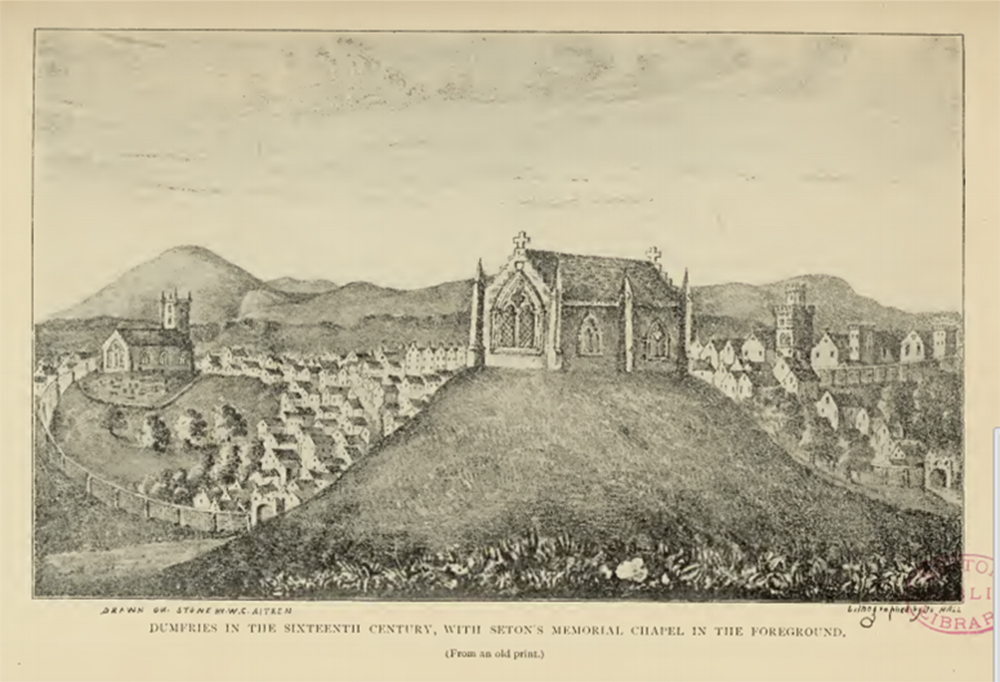
Seton’s Chapel and Dumfries in the 16th century, from an old print.
A print of the chapel has survived, which James Starke described, “Mr Gibson has procured a lithograph of Dumfries from the copy of an old print. The view is tasteful and felicitous, with the chapel in the foreground ; but it here appears of larger dimensions than would have been anticipated, and there is also more of the edifice exhibited than is perhaps warranted by the perspective. The object, no doubt, was to bring into view as much of the chapel as could conveniently be done, and the print may thus be deemed more valuable than if it had been more artistically correct.” 5
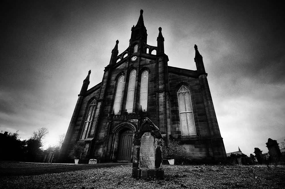
The few remaining stones still to be found, thought to belong to the east window, were set up in the churchyard by Major James Adair, with the inscription:
These stones, the relics of the ancient chapel, dedicated to the Virgin Mary, erected by King Robert Bruce, in memory of Sir Christopher or Chrystal Seatoun, are here placed by Major James Adair, 1840.
Other than this small collection of stones, nothing remains to be seen of the grisly history of this hill top. But when the cold autumn wind blows through the dying vegetation and the tumbled down tomb stones, despite being close to the town centre, it can feel like a very lonely place.
St Mary’s Church with Adair’s collection of remaining stones from the chapel in the foreground.St Mary’s Church, with the graveyard behind.
2. History of the burgh of Dumfries (106) – William McDowall (1867)
3. From the Dumfries Courier, 31 May, 1837. Sir Christopher Seton and his Chapel at Dumfries: DGNHAS Transactions and Journal of Proceedings, Series I, 2 (1863-64), 40: James Starke.
Keep me, my good corn, and my sheep and my bullocks From Satan, from Sin, and those thievish McCullochs. A Manxman’s Prayer
The ruins of Mytron Castle.
Myrton Castle now stands ruined and overgrown, hidden from view by trees, slowly crumbling on its mound in the grounds of Monreith House. A relic of a long-gone age, when fire and sword were often gleefully employed in settling an argument.
One of Galloway’s oldest names, the McCullochs had a fearsome reputation as a clan not adverse to conflict and feud. They held sway over Southern Galloway from the medieval period through to early modern times, said to be descended from Ulgric, who led the Gallovidians in King David I’s army at the Battle of the Standard in 1138. Like many old Galloway families, their first known documented mention in the area, is in the Ragman Roll of 1296, declaring an oath of fealty to Edward I1.
The McCullochs may have come by their lands in Wigtownshire due to their support of Lochlann (Roland) in his conflict over the Lordship of Galloway against his uncle Gilbert, late in the 12th century2. Their support of Edward I and John Balliol, son of Lady Dervorguila of Galloway, rather than Robert the Bruce, lost them their lands. They were at least partially restored however under David II, around 13633.
Little seems to be known about the early history of Myrton Castle. The motte is presumed to date from the 12th century and in the usual manner, would have been topped with a wooden building. The stone tower house dates from the 15th century, with 17th century modifications4.
The first recorded McCulloch owner of Myrton was Sir Patrick, named in English records in 13385, but it is the infamous Sir Alexander McCulloch from who the clan’s most fearsome reputation derives. A favourite of James IV, he was the King’s falconer, received visits from the King at Myrton Castle, when on his pilgrimages to Whithorn and was knighted by 1488.
Around 1497, Sir Alexander was for a short time appointed as the Sheriff of Wigtown, deputising for the ailing Quentin Agnew. Although his tenure as Sheriff was relatively short, he attacked and burned down Dunskey Castle, home of William Adair of Kithilt. Not yet content, he then moved on to Ardwell Castle, home of his kinsman Archibald McCulloch, driving off his cattle, sheep, horses and household goods6.
Sir Alexander also managed to incur the wrath of Bishop Vaux. When Mitchell McBriare was found liable for a debt of £10, he appealed to the Bishop, who forbade the Sheriff to foreclose on McBriare’s goods. Sir Alexander, resenting the Bishop’s interference accompanied his officers and instructed them to do their duty. The Bishop promptly placed a curse upon McCulloch.
“Whereupon, Bishop Vaux solemnly cursed Sir Alexander, ‘Knycht of Myrton’, he cursed the Sheriff Clerk, he cursed the sergeants and other officers whomsoever; he cursed them all ‘by candle, by book and by bell’: and then, committing the curses to writing, he caused Letters of Cursing to be served on all parties.”7
In 1507, Thomas Earl of Derby, Lord of the Isle of Man, attacked the Galloway coast, nearly destroying the town of Kirkcudbright. McCulloch unleashed furious reprisals, visiting raid after raid upon the island. It is said that Manxmen at mealtimes would finish their meat before their soup, so to at least have eaten something substantial before McCulloch’s next visit. He became so infamous, he passed into popular Manx culture as ‘Cutler’ McCulloch8.
“God keep the house and all within From Cut McCulloch and from sin.”
The final McCulloch owner of Myrton was Godfrey McCulloch, who is also the possessor of the dubious honour of being the final person to be beheaded by the ‘Maiden’ (a guillotine like structure) at the Mercat Cross in Edinburgh. Mired in debt, Godfrey sold Myrton to William Maxwell in 1683, but his situation was soon to get much worse. The McCulloch’s old feud with the Gordons reached its apex when on 2nd October 1690, Godfrey went to William Gordon’s house at Bussabiel to secure the release of impounded cattle. Gordon answered the door with a gun in hand and McCulloch shot him in the thigh, causing wounds from which Gordon later died. Godfrey fled abroad to England, where he remained for six years, returning to Scotland once he believed the matter had blown over. But one Sunday in a church in Edinburgh, he was recognised by a Galloway man who cried, “Steik the door, there’s a murderer in the house9.”
Godfrey McCulloch was tried and executed in 1697, but there is another, more supernatural version of the ending of this tale. In the early days of his ownership of Myrton Castle, Godfrey ordered a drain to be cut in the mound, when a little man in a green coat appeared to protest that the mound was the home of fairies and drain was being cut through their house. The fairy promised if he stopped, he would one day receive a great reward, but if he didn’t, he would have to face the wrath of the fairies. Godfrey had the drain diverted. On the day of his execution, Godfrey was said to have been rescued by a little man, dressed in green upon a white horse and spirited away, never to be seen again10.
Myrton Castle remained in use until Monreith House was built by Sir William Maxwell, 4th Baronet, in 1791 on the site of Myrton village. The castle was converted to a doocot around 1800.
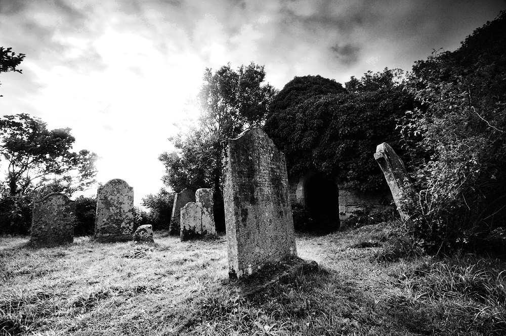
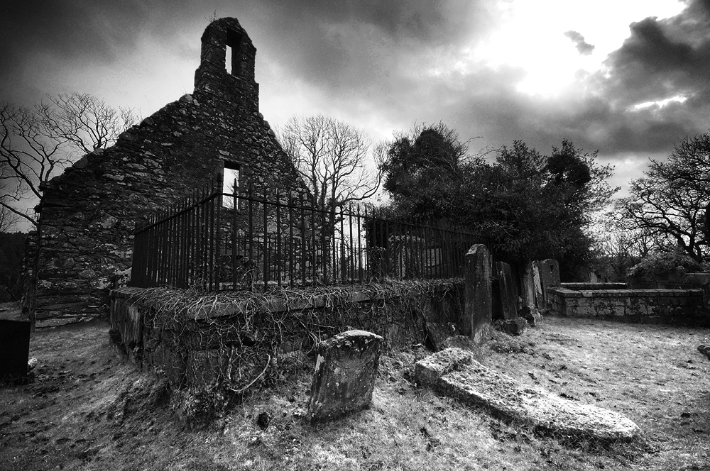
Kirkmaiden Church, burial place of the McCullochs.
Kirkmaiden Church near Monreith, thought to be one of the oldest churches in Scotland, is the ancient burial place of the McCullochs and has long held a rather eerie reputation, with numerous legends attached to it. Long ago, a merry gathering was held at the old house of Moure, the original home of the Maxwells of Monreith, now known as Dowies. As the night wore on, talk turned to dark tales of bravery and one foolhardy young man accepted a wager that he should ride to Kirkmaiden and return with the church bible to prove he’d been there. Night ceded to morning and still the young man had not returned. His body was later found in a bleak place, next to that of his horse, with both of their entrails twisted around a thorn bush. It seemed he had reached the church and was on his way back when he met his fate11.
Sometime before Andrew Symson wrote his ‘Large Description of Galloway’ in 1684, the parish of Kirkmaiden merged with Glasserton. The bell and pulpit were taken across Luce Bay to the other, newly built Kirkmaiden church in the Rhins. Although it was a clear and still day, a storm blew up in which the ship floundered and sank. Now and again, much like the prophetic howl of the banshee, the bell can be heard to toll from the watery depths of the bay, signifying the death of a McCulloch is approaching12.
Sources
1. A History of the Galloway Families of McCulloch – Walter Jameson McCulloch (1964) 2. Galloway. A Land Apart – Andrew McCulloch (2000) 3. W.J. McCulloch (1964) 4. Canmore website: https://canmore.org.uk/site/62795/myrton-castle 5. W.J. McCulloch (1964) 6. W.J. McCulloch (1964) 7. W.J. McCulloch (1964) 8. W.J. McCulloch (1964) 9. Highways and Byways in Galloway and Carrick – Dick (1924) 10. A History of Dumfries and Galloway – Herbert Maxwell (1896). 11. Witchcraft and Superstitious Record in the South-Western District of Scotland – Maxwell Wood (1911) 12. Maxwell Wood (1911)
At first sight, the neo-gothic edifice of Minnigaff Parish Church looks much like many others of the period. As you walk past the neat wall and railings, into the churchyard containing well-kept Victorian tomb stones, there are few clues of what lies ahead. But the deeper you probe, the more secrets this intriguing churchyard reveals.
Standing on a promontory, formed between the waters of the Cree and Penkiln Burn, this sliver of land holds at least nearly 1000 years of history. Beyond the 19th century church are the ruins of a much older building, surrounded by tombstones and burial plots. At the southern tip of the churchyard, taking advantage of the natural topography, surrounded by steep banks, stands a motte, separated from the rest of the churchyard by a deep ditch, cut across its northern edge and would once have been surmounted by a wooden keep, surrounded by a palisade. It is of a type generally associated with the Anglo-Norman period and the area now covered by the churchyard may once have formed the bailey.
Andrew Symson describes the motte in 1684;
‘The village of Minygaff being situate at the foot of Polkill, in a low ground hard by the Church , there being an artificiall moat, which , by tradition , hath been handed down to posterity , as being at first contrived for sacrifising to Jupiter and the Heathen Gods ; and when Christianity obtained, it was used as a mercat – place for the inhabitants to meet and do business…’ 1
There seems here to be the tantalising suggestion of a pre-christian use for the site, a dim and distant memory of a place of pagan practice. Perhaps a prehistoric temple of some kind may have existed here before the motte and church. It’s not something beyond the realms of possibility, considering the number of prehistoric remains in the area.
Further upstream along the Cree, is a place still known as Wallace’s Camp, where local tradition tells a battle was fought nearby. R.C. Reid in his 1924/25 field trip account2, is of the opinion Wallace utilised an existing stronghold from antiquity, but the Canmore database describes the site as being caused by the extraction of gravel or sand from the old river terrace, rather than the remains of a camp. Reid continues, drawing from Blind Harry’s epic poem, ‘The Wallace’ in support of an assault on the Minnigaff motte castle by Wallace in 1297.
“A strenth thar was on the Wattir of Cre With in a rock, rycht stalwart wrocht off tre; A gait befor myeht no man to it wyn, Bot the consent off thaim that duelt within. On the bak side a rick and wattir was…”
The tale tells how Wallace and two companions, William Kerlie and Steven of Ireland, climbed the rock on which the impregnable castle stood, slew the sentry and took the castle. Blind Harry lived from 1440-92, writing some 170 years after Wallace’s death, claiming it to be based on a book by Wallace’s friend, Father John Blair. The book is unknown in modern times and it is thought his poem is more likely to be based on oral traditions. He is not considered to be a highly reliable source.
Reid surmises that the motte is the only site on the Cree which fits the description. However, Cruggleton Castle was also known as the ‘Black Rock of the Cree’. Tradition, if not history, states that Cruggleton had been held by the Kerlies for as long as could be remembered, until they were usurped by the deceitful William de Soulis in 1282, who handed the castle over to Edward I. With William Kerlie in his company, it seems far more likely Wallace would have retaken Cruggleton Castle for his friend. When Edward’s man John of Hoddleston at Wigtown Castle heard that Wallace was approaching, he fled ‘back to his own country’ leaving Wallace to take the castle and progress to Cruggleton. Although some mottes continued to be used until the 15th century, many fell out of use in favour of sturdier, stone built castles. So it may be the motte at Minnigaff had been abandoned by the time of Wallace’s campaign. Read more about Cruggleton Castle here.
The first record of the church is in 1209, when Parson Durand attested a deed. His name appears on a witness charter by John, Bishop of Galloway3. The presence of two early cross slabs also suggests at least a tenth or eleventh century origin for the church. One slab was found in 1880 within the fabric of the old church, in use as a doorstep, the other being used as a lintel in the old market house in Minnigaff at about the same time. Both were set up in a recess in the ruined church, but have now been moved inside Minnigaff Parish Church4. The crosses may suggest the church predates the motte and there is a possibly that the complex of a church and motte together, was an early lordship centre5, perhaps founded by Fergus of Galloway.
View to the east along the aisle.Winter in the kirkyard.
‘We next approached the two gable walls, ivy-covered, of the old parish church. It is more than half-a-century since worship was conducted in it, and it now contains several graves in the interior. But there are preserved within the walls a very fine Maltese cross, granite, erected on an ornamental pedestal, and of unknown date. It has been surmised that it was in honour of the four Evangelists, and certainly a human figure is sculptured on one of its sides. A cross of ruder form and older date was excavated out of the walls of this old church, and is now to be seen beside the other. A sculptured slab over the grave of an ecclesiastic, inserted in the church wall, has been removed.’6
There are clues in the surviving stonework, which tell us the old church has been renovated and remodelled a number of times. A medieval church would have stood here and the twin-light lancet windows in the east gable are probably the only surviving features of that building.
It seems likely that the medieval church was of the Premonstratensian order, as Tongland Abbey, founded as a Premonstratensian Abbey, later annexed Minngaff Church7. Very little is known of the church during this period, which seems to have undergone major reconstruction sometime after the reformation. The majority of the current church probably dates from the seventeenth century, with the east door certainly dating from the post-reformation period, as passing the altar during entering and leaving the building, was reserved solely for the priest8. A stone bearing the date 1706 sits in the east gable, which almost certainly attests to the date of a later remodelling.
‘There are in this churchyard some very old tombstones, said to be the oldest in Galloway. We noted one, dated 1416 – A. Murray – memento mori. It also contains a considerable number of monuments of elegance and taste, and the dust of a number of Galloway’s great and good repose in its precincts.’9
The Heron Monument.
On the western edge of the cemetery stands the Heron Monument, consisting of a pediment supported by two Corinthian columns, enclosed behind balustrade walls and a heavy iron gate. It is by far the most ornate tomb in the burial ground. Built in 1761 for Patrick Heron of Kirroughtree, who’s family had gained the estate through marriage in the 15th century. His father was also called Patrick and was described as a ‘ring leader’ for the Covenanters at the Battle of Bothwell Brig in 1679. He was the MP for Kirkcudbright from 1727-41 and was instrumental in diffusing tensions during the uprising of the Galloway Levellers in 1724.
Buried with him is his son, confusingly also christened Patrick and married to Elizabeth Cochrane, a cousin of James Boswell. He too was elected as the Whig MP for Kirkcudbright in 1793, eliciting support from none other than Robert Burns, who visited Kirroughtree House and devoted a number of ballads to his election10.
But mark ye! there’s trusty Kerroughtree, Whose honor was ever his law…
Another notable inhabitant is Sir William Stewart, about whose father, John Stewart, 7th Earl of Galloway, Burns was less complimentary. After a distinguished military career, including serving on the HMS Elephant with Nelson, throughout the battle of Copenhagen in 1801 and in the Peninsula War under Wellington, he retired to Cumloden near Minnigaff, where he died on 7th January 1827. He was also the MP for Wigtownshire on a couple of occasions. His casket style tomb lies close to the outer wall on the south eastern side of the old kirk.
View to the west along the aisle.The old kirk and tombs from the north.
Inside the church, above a recess is a heavily decorated memorial stone to Uchtred M’Dowall. The lion rampant crowned is the arms of the M’Dowalls. The three boars’ heads stand for Gordon. At the close of the 16th century two Patrick M’Kie’s of Larg married heiresses of those families. The heraldic stone is therefore 17th century and probably refers to Sir Patrick M’Kie of Larg, who ruined the family fortunes in the Covenanting period11.
There is another stone of the M’Kie family, depicting two raven, skewered by a single arrow. This refers back to a very well-known legend, dating from the Wars of Scottish Independence. During the early years of his campaign, Robert the Bruce was hiding out in the hills of Galloway from Edward’s troops. One night he came to the house of a widow at Craigencallie, who offered him food and shelter. She had three sons, all of who demonstrated their skills with a bow, the eldest son called M’Kie shot two ravens with a single arrow. All three sons joined his army, helping with the defeat of the English at the Battle of Raploch Moss in 1307. After Bannockburn, Robert awarded the widow with the lands between Palnure and Penkiln, which she divided between her sons, originating the families of M’Kie of Larg, Murdoch of Cumloden and M’Lurg of Kirroughtree12.
Emboldened by his success at Raploch Moss, Robert was eager to drive out any further scattered bands of English troops, who may lay in wait. Lord James Douglas had passed a village where 200 were stationed without posting a sentry, the Scots immediately rushed to the village and cut them to pieces. Although the name of the village isn’t given, it is the opinion of James G. Kinna that Minnigaff was the scene for the slaughter. He continues, a number of troops may have taken refuge in the church, as was the custom at the time, only for it to be set alight with them inside, “at a depth of two feet under the floor of the old Church there is a deep layer of bones covered with burnt and charred slates of a very rude description.” 13
Over 600 years of worship in the old church came to an end in 1836, when it was replaced by the current Parish Church. The old yew tree by the gate, thought to be about 900 years old, still grows on. The history this tree must have witnessed is thought provoking in the extreme. From its early days as a possible residence of the Lords of Galloway, through the centuries of catholic worship, the turbulence of the reformation and the covenanting days, through the Wars of Independence and the War of the Three Kingdoms.
Maybe it was the church that arrived here first, to Christianise a formerly pagan place of worship and the motte and lordship centre followed. If so, that would mean this had been a significant place for possibly thousands of years. And with the possibility that some of Scotland’s most heroic national figures may have passed under its shade, this tree has witnessed so much history and maybe, many secrets yet to be uncovered.
Tombs overgrown with the patina of age.
References 1. A Large Description Of Galloway – Andrew Symson 1684 (pub. 1823). 2. DGNHAS Transactions and Journal of Proceedings 1924-25 Third Series Volume 12 – R.C. Reid. 3. History of the Parish of Minnigaff – James G. Kinna (1904). 4. Canmore: canmore.org.uk/site/319607/minnigaff-old-parish-church-burial-ground-cross-slabs 5. Historic Environment Scotland: portal.historicenvironment.scot/designation/SM11054 6. DGNHAS Transactions and Journal of Proceedings 1891-92, Second Series Volume 8 – Author not given. 7. Kinna (1904) 8. Ibid. 9. Rambles in Galloway – Malcolm M’Lachlan Harper (1876). 10. Thank you to Andrew Wilson for bringing this to my attention. 11. R.C.Reid (1924-25). 12. Ibid. 13. Kinna (1904)
A tangible sense of weirdness hangs in the air, along with the sea mist rolling in over Luce Bay. The silence, punctuated only by the plaintive cries of oyster catchers, lends Luce Sands a lonely atmosphere of ancient liminality. When the sea retreats, uncovering a great expanse of sand, it can be an unsettling place, both beautiful and otherworldly in equal measure. Where the Water of Luce and Piltanton Burn meets the sea is famed for the speed of its incoming tide, which can work its way around the unwary, cutting you off. There is a deep sense of history here, at low tide medieval fish traps built by the monks of Glenluce Abbey are uncovered and the dunes behind you have turned out finds dating all the way back to the Mesolithic1. It is no wonder that the Devil appears to be so fond of visiting this area.
There is a story that says it was here, close to the bay the famed medieval magician Michael Scot2 built his house, just by the shore. A simple house with simple furnishing, but he became rather fond of the drink, causing his wife to leave, retreating to her mother’s for the sake of their children. Determined to win her back Michael stopped drinking and improved their house, buying in better furnishings and building a chimney with a fireplace to replace the fire on the floor. He thought his wife would be so impressed, she would be back in no time. The Devil however had other plans for Michael Scot.
Returning home one day, Michael heard a demonic laugh on the roof above him. There leaning on his newly built chimney stood a demon. Never being one to take defeat well, the Dark Lord was still smarting from being beaten in a bagpiping challenge by the wizard3, allowing him to trap the plague in the dungeons of Glenluce Abbey. Now he wanted revenge and had sent one of his hellish minions to wreak havoc. Michael went inside and much to his dejection found the house turned upside-down. His new furniture was upended, his new curtains torn down and ashes from the fire scattered all over. He tidied up, put the furniture back where it belonged, rehung the curtains, made his supper and went to bed. The next day, he returned home found the same thing again and again the next day and again after that.
Seeing he needed to take matters in hand, the wizard invited the demon in for a drop of porridge and asked him how long he intended to stay.
“For the rest of your days,” answered the demon.
“How can I get rid of you?” asked Scot.
“Only if you ask me to do something I can’t,” said the demon, “you have three attempts.”
The wizard asked the demon to bring him a bag of gold, the condition being it couldn’t be stolen. Off went the demon, searching over the Galloway hills until he found an old burial chamber. Hauling back the rock, he pulled out a hoard of gold and sped back to the cottage.
“Ach, you beat me,” said the wizard thinking hard. Next he asked the demon to bring him a boat, but it couldn’t be begged or stolen and it had to be new. Once again the demon sped out of the door, onto the wet sand, across the bay and out into the Irish Sea, where he found a brand new, sunken fishing boat waiting to be claimed as salvage. He emptied the boat of water and dragged it back up the beach to the waiting wizard.
“One more try,” said the demon.
Luce Sands at low tide.
Michael Scot stared out across the Solway sands4 and finally spoke, “that’s a fine boat and we get lots of storms here, what I need is a rope to tie it to the shore. But I want you to make the rope out of sand.”
The demon laughed, this was going to be the easiest challenge yet. He set to work and within minutes he’d made a magnificent rope, but before he could admire his handiwork, in raced the tide and swept the rope away. No matter how he tried, each time he fashioned the rope anew, the tide would race in and destroy his work and he never returned to the house of Michael Scot, who had once again beaten the Devil.
The Devil’s encounters with the famed wizard aren’t the only occasion on which strange happenings have visited Glenluce. George Sinclair’s 1685 book ‘Satan’s Invisible World Uncovered’ tells of an episode in 1656 that has come to be known as ‘The Devil of Glenluce’5. In what sounds like a classic account of poltergeist activity, the home of a weaver named Gilbert Campbell and his family suffered furniture to be moved, their home to be pelted with stones and even their beds to be set on fire. It began after a beggar named Alexander Agnew6 was refused alms at their house and placed something of a curse on the family. North of Glenluce, Cambell’s Croft still stands and nearby are the tantalisingly named Ghaist Hall and De’il’s Well.
Walter Scott’s ‘The Lay of the Last Minstrel’ places Michael Scot in the Scottish Borders, cleaving the Eildon Hills into their three distinctive peaks, so it is tempting to conject that Michael Scot was inserted into a version of the tale of the ‘Devil of Glenluce’ in order to strengthen his association with Glenluce Abbey.
Upon his death in about 1132, Scot is said to have been buried in Melrose Abbey along with his books. In his 1911 book ‘Witchcraft and superstitious record in the south-western district of Scotland’, J Maxwell Wood tells of a terrifying vision one bold soul encountered when he opened what was believed to be the tomb of Michael Scot. There, sat among his books was the upright skeleton of Scot. The vision is said to have driven the man insane with fright.
Back on the open expanse of Luce Sands, they say that every so often the winter storms expose fragments of the rope of sand near Ringdoo Point and if you listen very carefully, sometimes above the wind and the calls of sea birds, you can hear the demon’s anguished cries of frustration as yet another incoming tide washes away his endeavours.
The remains of medieval fish traps, built by the monks of Glenluce Abbey.The remains of medieval fish traps, built by the monks of Glenluce Abbey.
Notes 1. Mesolithic remains have been found in the dunes at Torrs Warren and ancient weapons on the surrounding farmlands, leading Hector Boece to deduce a battle had taken place here between an alliance of Scots and Northern Picts on one hand and the Galloway Picts on the other (Highways and Byways in Galloway and Carrick – C.H. Dick 1916). It is more probable that these are votive offerings or grave goods from the prehistoric period as just a short walk leads you to Droughdool Mote, a huge Neolithic mound over-looking the multi-period Dunragit ceremonial complex (https://www.guard-archaeology.co.uk/DunragitBlog/DunragitMonograph.html).
2. The historic Michael Scot was born around 1175, possibly in Fife or in the Scottish Borders and was one of the most illustrious men of his age. He was educated in Oxford and Paris, mastered several languages including Arabic, Greek, Latin and Hebrew. He served in the court of Frederick II, King of Sicily from 1198, King of Germany from 1212, King of Italy and Holy Roman Emperor. He is featured in Walter Scott’s ‘The Lay of the Last Minstrel’ and in Dante’s ‘Inferno’.
3. Another version of this tale involves a drunken piper from the Highlands named Tam Campbell, who encounters the devil while on his way home from Glenluce to Crows Nest.
4. Another version of this tale is set on the beach at Kirkcaldy.
Close to the beach at Back Bay near Monreith, is one of the most atmospheric and beautiful kirkyards in Galloway. The ruined church of Kirkmaiden sits on a wooded slope, a dark ages burial site and one of the oldest churches in Scotland, in an area that is a riot of history and folklore. Liberally strewn with standing stones, ancient rock art and hill top forts, the long story of this short stretch of coastline is both compelling and confusing in equal measure.
The story of Kirkmaiden goes back to the early days of Christianity, when missionaries sought out remote places to practise their faith. Medana is said to have been a beautiful 7th or 8th century Irish princess with many suitors. Upon her conversion to Christianity, she fled her native land to escape their attentions and landed with her handmaidens in the Rhins of Galloway. There among the cliffs, on the shoreline she established her first chapel.
Within time, the most determined of her suitors found her and she once again evaded him by swimming out to a rock, which magically bore her and her handmaidens across Luce Bay, landing on the beach at Monreith. Once again he followed and found her and her attendants asleep on the shore. A cock crowed at his approach and woke Medana, “what is it about me that you find so attractive?” she appealed. He replied that it was her eyes that he could not live without, so she plucked them from her head and handed them to him, to which he fled in horror.
A spring appeared at her feet, in which she washed her bleeding face and her eyesight was restored. She founded another chapel on the beach, known as Kirmaiden-in-Furnis and the well is now known as St Medana’s Well, which is said to cure whooping cough and is a cure for all ills if you bathe in it at sunrise on the first Sunday in May.
Some of the story’s main elements are not exclusive to this tale. According to the 16th century Aberdeen Breviary, St Triduana of Colosse in Greece landed in Scotland in c.337AD. The beauty of her eyes attracted the unwelcome attentions of the Pictish King, but in order to repel his advances, she plucked them out and sent them to him impaled on a pin1.
Stone boats and miraculous transportation across water are common motifs in early Christian mythology and can be found elsewhere in Scotland, Ireland and Europe. The boat was an early symbol of the Christian church, a haven among tumultuous seas of disbelief, also that faith in God is rewarded by salvation. Imposing Christian interpretations upon sacred rocks and wells was also a common device used by missionaries, in their endeavours to convert local populations away from Paganism. Neolithic rock art on the cliffs above St Medana’s Well, points towards a possible pre-Christian association.
A cupmarked rock on the cliffs above St Medana’s Well, overlooking the bay.
St Boden was a Scottish saint who accompanied St Columba, when they were chased back to their boat by a group of Picts, St Columba reached the boat first and left St Boden on the shore. When Boden called to him to come back, Columba replied to have faith. The rock on which he stood floated out to sea and transported him back to Ireland. The reputed rock which bore him still stands in the Culdaff river in Donegal, next to St Boden’s Well, where the saint stepped ashore.
Besides St Medana’s Well, there is another little known well at Monreith Bay, by either chance or design known as Boden Walls Well. This lends the intriguing possibility of two tales of miraculous journeys attached to this short stretch of coastline. Is the story of a second early Christian saint celebrated at this well? If this is the case, with St Ninian’s Cave just three miles to the south, the south west coastline of the Machars can boast an impressive saintly head count. It is interesting that the story of St Boden sees him traveling in the opposite direction to St Medana, have the two stories somehow become conflated and confused? St Medana goes by many other names, St Medoc, Madoc, Madin and the ‘maiden’ element of Kirkmaiden could be a smoothed out derivative of ‘Mo Aiden’ (my Aiden), meaning that Medana possibly wasn’t even female.
Of course, not unlike both saints, this supposition is taking a bit of a leap of faith and the true etymological origin of the name Boden Walls Well, could come from an entirely different source. Several languages have washed across this area of Scotland over the last two thousand years, all of which have left their mark on local place names and could form the root of ‘Boden’. There are a number of possibilities. The Brittonic word ‘bod’2 meaning a humble dwelling or homestead, is a contender as there are a number of homestead remains on the land above the cliffs, the likely dates of which would span that last few centuries BC to the first few centuries AD and correspond to the period when Brittonic languages would be extant in this area, or perhaps the later Northumbrian ‘bōðl’, or ‘botl’ meaning the same.
Another good contender is the Goidelic word ‘bad’, meaning a place, spot or clump. As many of the surrounding place names are derived from Gaelic (Craigdhu, Monreith, Drumfad and Barhuillion among others), this isn’t beyond reason either3.
Just as likely is the possibility that Boden could be the name of a person, such as the Anglicised version of the Irish name Ó Buadáin, or the Germanic word ‘boden’ meaning the sea bottom, ground, floor of a cave. This could well be cognate with the ‘Walls’ part of the name to, which very likely refers to the vertical sea cliffs under which the well sits, which also contain a number of caves and recesses.
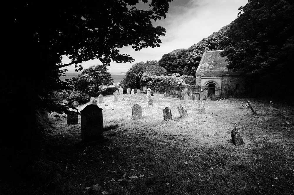
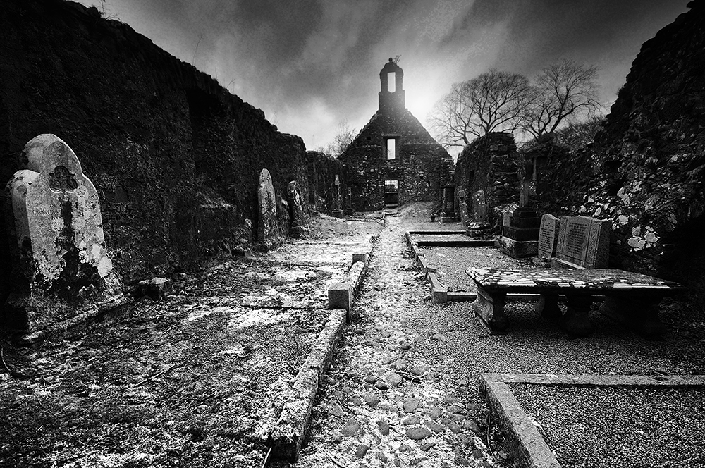
Kirkmaiden and it’s burial ground, showing the restored chapel of the Maxwells.
Returning to Kirkmaiden Church, the fabric of the standing church walls are thought to date from around the 11th or 12th century, but the foundations under the present ruins are much older, possibly going back as far as to the 7th or 8th century. Fragments of early Christian crosses were found here and the kirkyard still bears a stone depicting a cross upon a calvery and a broadsword, popular motifs around the 14th century. It has been suggested that Kirmaiden may once have been the home of the Monreith Cross, which has travelled around the area to its current location in Whithorn Museum, via Court Hill and the front lawn of Monreith House. Legend says that when the Maxwells bought Myrton Castle from the McCullochs, the first baronet wished to take the old cross with him. Upon moving the cross, flames burst out of the stone and the cart was upset, breaking the shaft in two. It was hastily returned and set back up. There it stayed until 1799 when it was moved without incident to sit beside the newly built Monreith House4.
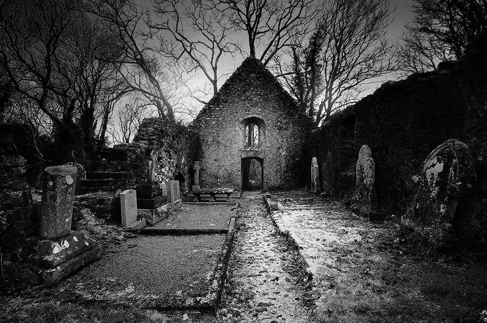
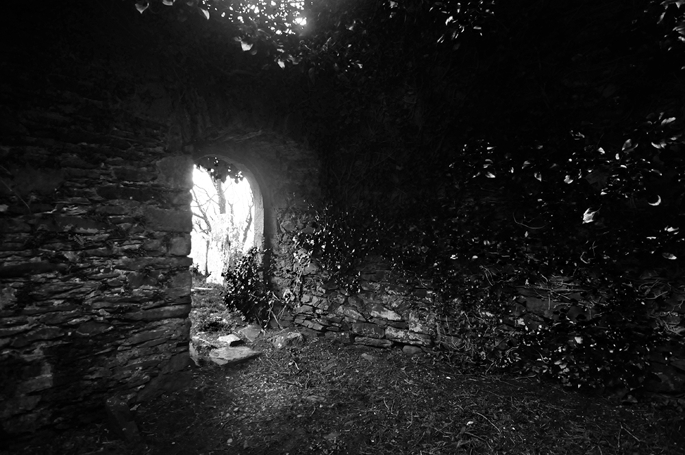
The doorway of the ruined church.
The churchyard has long been the burial place of the McCullochs, when Kirkmaiden was merged with the parish of Glasserton, the bell and pulpit were taken across Luce Bay to the other, newly built Kirkmaiden church in the Rhins. Although it was a clear and still day, a storm blew up which sank the ship, “for, as true believers knew, the bell had been consecrated, and on no account could it ring ’neath the rafters of a Presbyterian building.”5 Now and again, the bell can be heard to toll from the watery depths of the bay, signifying that the death of a McCulloch is approaching. The 17th century bell tower however, did manage to survive the journey to Glasserton, where it can still be seen on the church roof.
The body of Francois Thurot, a French privateer and smuggler who raided British shipping during the Severn Years War, lies somewhere in the burial ground, but his grave is now lost. He was killed in 1760 during a battle with the Royal Navy between the Mull of Galloway and the Isle of Man. His body was thrown overboard, eventually washing ashore at Monreith Bay, where William Maxwell provided him with a decent burial.
It is clear, this short section of coastline has been important for a very long time. From the Neolithic rock art on the cliffs above St Medana’s Well, to the tales of early Christian missionaries and the lasting importance of the church founded on its cliffs. Monreith and its coast have plenty more tales to tell.
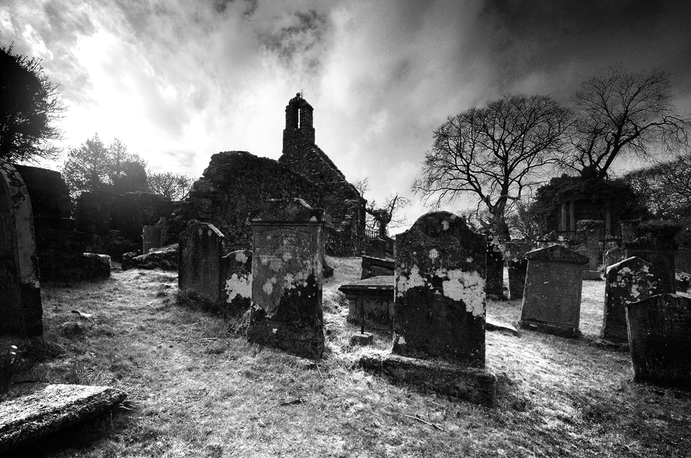
Kirkmaiden churchyard as sunset approaches.And after nightfall.
Sources 1. The Legend and Shrine of Saint Triduana – Foster (1952). 2. Brittonic Language in the Old North Vol 2 – James (2019). 3. Thanks to the Whithorn Trust for their assistance with this. 4. Highways and Byways in Galloway and Carrick – Dick (1924) 5. Witchcraft and Superstitious Record in the South-Western District of Scotland – Maxwell Wood (1911)
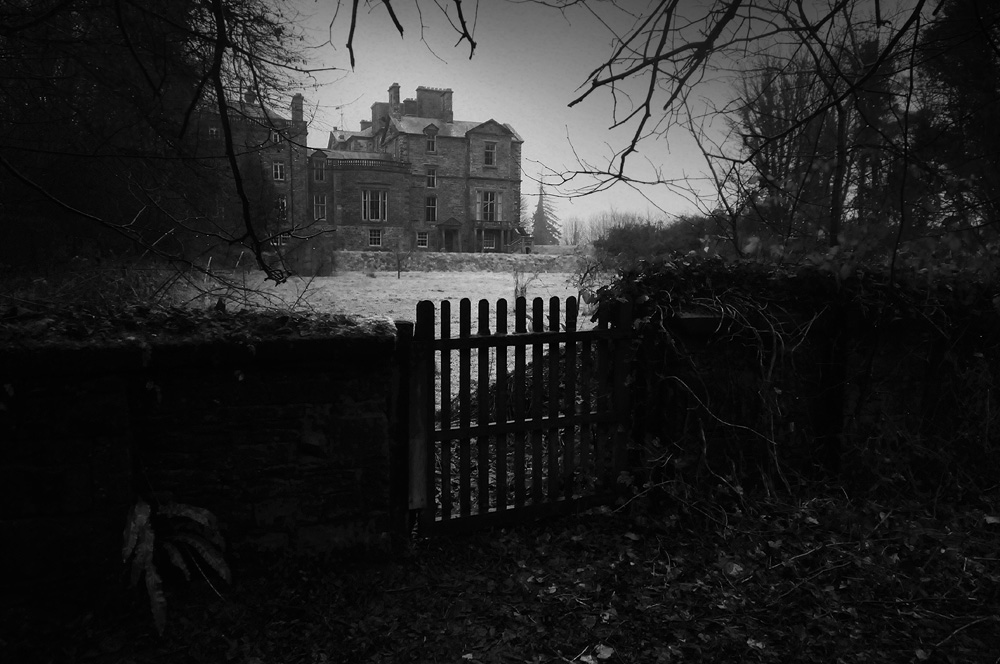
Galloway House, was begun in 1740 as the seat of Lord Garlies Alexander Stewart, the sixth Earl of Galloway. It has had its share of ‘interesting’ owners and was at the centre of a feud with Scotland’s best known poet.
John Stewart, the seventh Earl of Galloway (1736–1806), founder of the adjacent village of Garlieston, was described by James Boswell as having “a petulant forwardness that cannot fail to disgust people of sense and delicacy.”
He was variously described as, “an ambitious self-seeking opportunist, almost fanatical in his zeal to exalt his family interest, hated by his opponents, and distrusted even by his friends. He had few merits except a certain facile charm, to offset his ill-temper, arrogance, insincerity, and avarice. His own heir was ashamed of his father’s reputation, his lack of ‘consistency and dignity of character … the surest cause of his failure in many things.”
He also attracted the ire of Robert Burns, when he is said to have refused him entry to his house on grounds of disagreeing with his politics, who described him in his poem ‘On the Earl of Galloway’.
On the Earl of Galloway Robert Burns 1793
What dost thou in that mansion fair? Flit, Galloway, and find Some narrow, dirty, dungeon cave, The picture of thy mind.
No Stewart art thou, Galloway, The Stewarts ‘ll were brave; Besides, the Stewarts were but fools, Not one of them a knave.
Bright ran thy line, O Galloway, Thro’ many a far-fam’d sire! So ran the far-famed Roman way, And ended in a mire.
Spare me thy vengeance, Galloway! In quiet let me live: I ask no kindness at thy hand, For thou hast none to give.
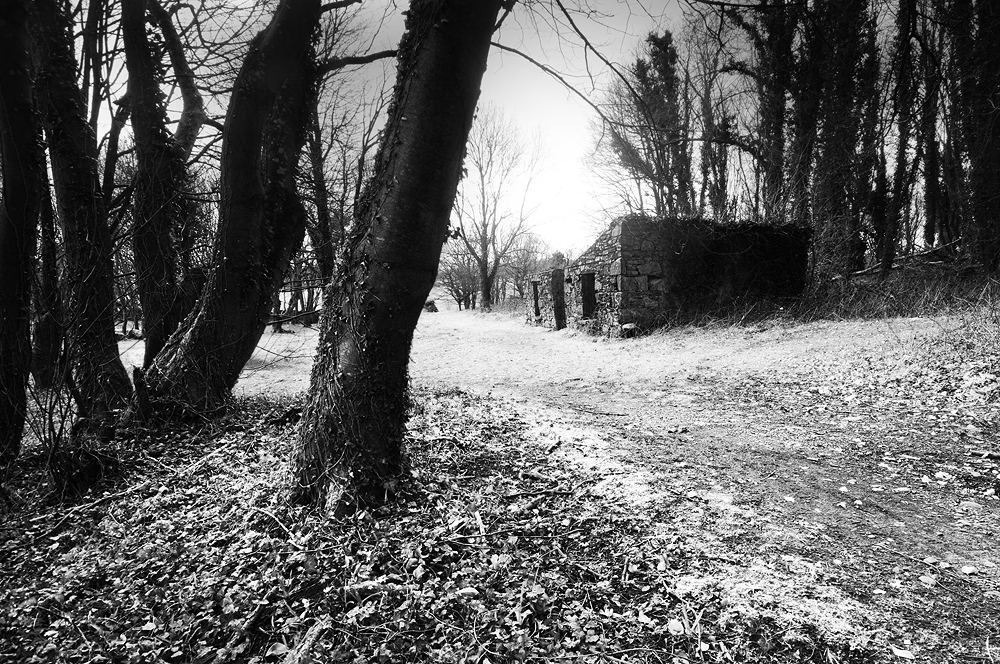
The fortunes of the family slowly declined, depleted by the lavish cost of keeping the house and estate, resulting in its sale in 1908. The house passed through several hands and has also served as a serviceman’s convalescent hospital during World War II and as a boarding school. It is also interesting to note that the wall surrounding the estate grounds was built by French prisoners taken during the Napoleonic Wars. Also, the village of Carswell was cleared when the estate grounds were laid out. The ruins of one can still be seen near the shoreline of Rigg Bay.
A melancholy atmosphere of faded glory and lost fortunes now settles quietly around the house and gardens. A strong sense of history lingers along the coastal walk through the estate, around Rigg Bay and up to the ruins of Cruggleton Castle, which itself is another story.
Ruins of a cottage from the cleared village of Carswell, near the shore at Rigg Bay.