An’ siccan pranks by the haunted thorn They hae the po’er to play, That mortal man was never born Could see , an’ live till day!
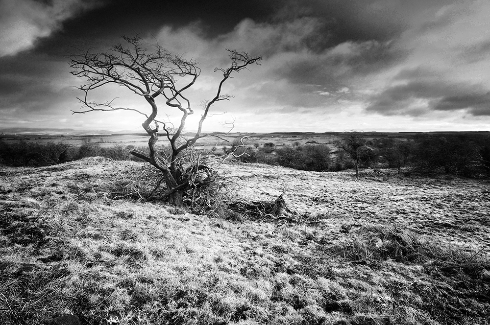
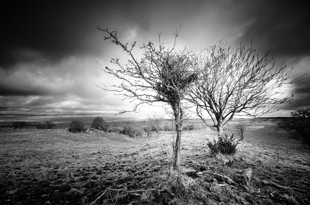
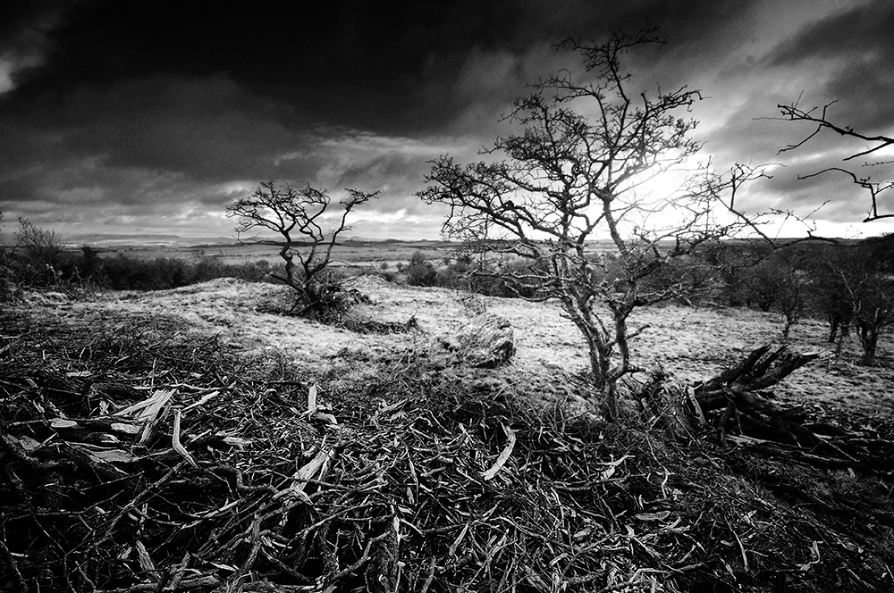
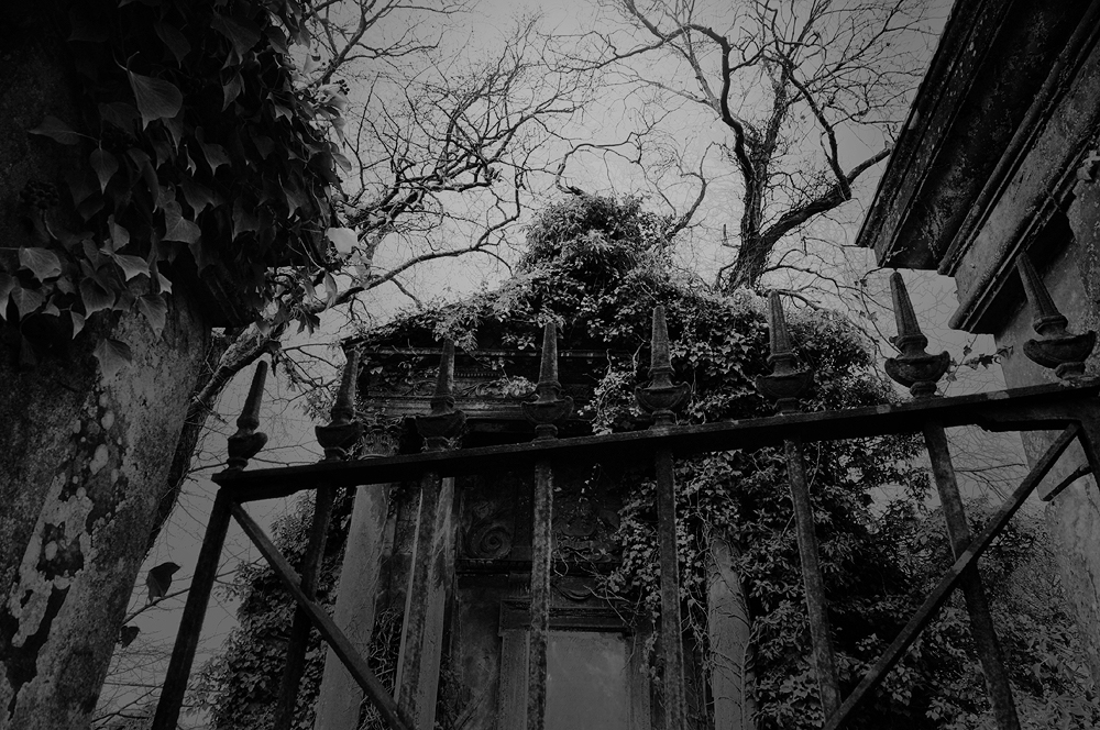
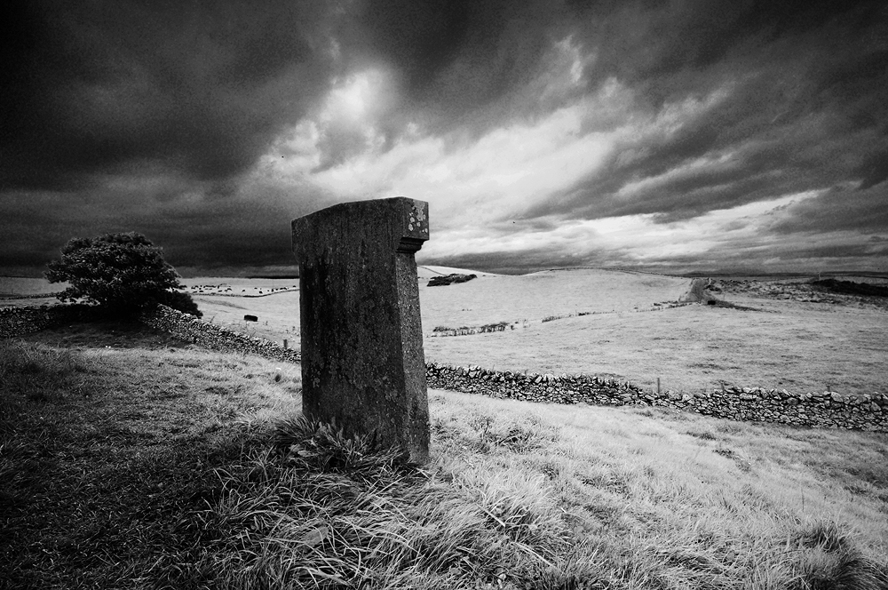
A twisted hawthorn tree at Man Wrap.
It is the days when the wind drops, you really notice the difference. Snow rarely falls on the fringes of the Machars peninsula, but a cold, cutting wind is an almost constant companion during winters in these lands. Contorting the bare skeletons of stunted trees, into horrific, twisted creatures.
The Legend O’ Kirkmaiden tells that on such a night, with a storm raging around the ancient Fell of Barhullion, a merry gathering took place at the nearby old House of Moure, the original home of the Maxwells of Monreith. As the evening wore on and the guests partook freely of the hospitalities, talk turned to the supernatural. Bravado flowed as freely as the drink by the warmth of the fire, as the guests told tales of bravery and indifference of all things dark and uncanny, until a young man declared he would ride to the church of Kirkmaiden and return with its bible, as proof he’d been there1.
Despite dire warnings from ‘Jock of the second sight’ to avoid the haunted hawthorn tree, the foolhardy young McCulloch, full of drink and valour, replied that he’d not only pass by the tree, but also cross the witches lair2 and rode off into the teeth of the tempestuous night.
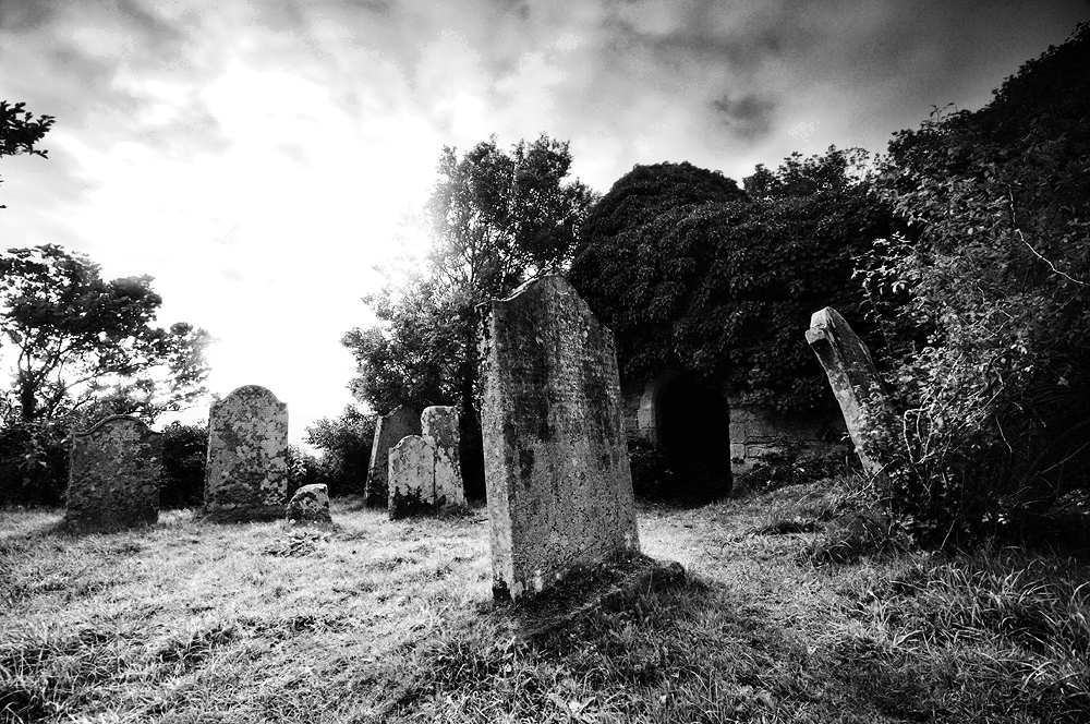
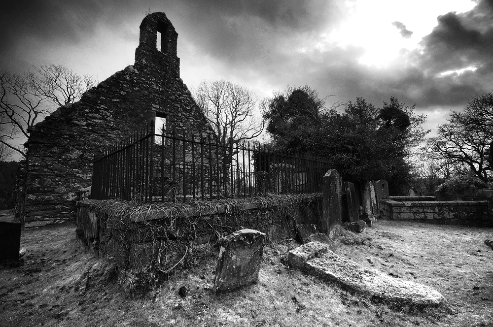
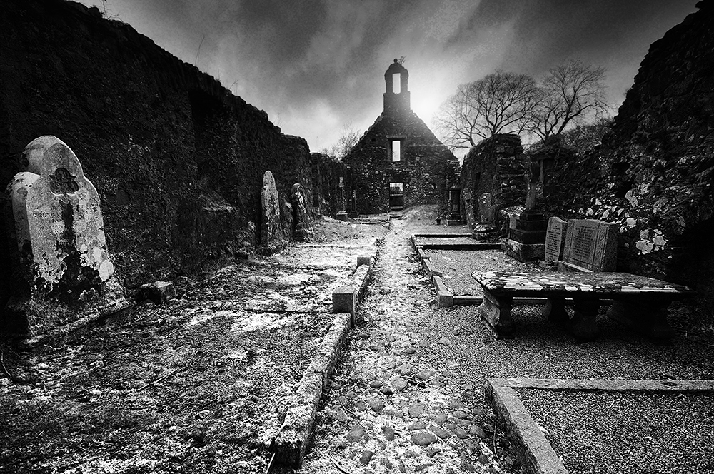
The ruins of Kirkmaiden church, beside Monreith Bay.
As the night wore on and despite Kirkmaiden only being a short ride away, McCulloch did not return. Once daylight broke, a search party set out and found his body and that of his horse laying in a bleak spot, with both of their entrails entwined around the haunted hawthorn. He had reached the church and was returning to the House of Moure with the bible.
M’Culloch’s bluidy corpse they saw, In’ the licht o’ that awfu’ morn, Wrapp’d roun’ in the thorny branches a’ , An’ the heart frae the body torn!
What foul fiends’ wark the youth did dree That nicht, there’s nane can say, But weel kent is that hawthorn tree Ca’d ” Man-wrap” to this day.
A twisted hawthorn tree at Man Wrap.
It is difficult to ascertain when the story is set. Kirkmaiden merged with the parish of Glasserton, sometime before Andrew Symson wrote his ‘A Large Description of Galloway’ in the 1680s, in which he describes the church as ruinous. The original House of Moure came into the possession of the Maxwell family circa 1450, via the marriage of Edward Maxwell to an heiress of the de Mundeville family. It was replaced by the tower house now known as Dowies in the late 16th/early 17th century, but the name transferred to the new building3. This in turn was abandoned in favour of Myrton Castle when William Maxwell bought it from the McCullochs in 1684. It seems almost certain the story would be set well before this date.
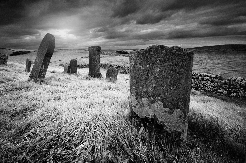
Man Wrap is a bleak area of rough, stony ground beneath the eastern side of the Fell of Barhullion, populated by a number of twisted hawthorn trees. The name survived long enough to be included on the first Ordinance Survey map of the area in the 1840s.
Today, little has changed and it is obvious few visitors tread here. On a gloomy winter afternoon, you stumble on the uneven, frozen ground in the half light. Gnarled branches grab at your coat and scratch your face. The wind grows colder as the sun sets and the place manifests an atmosphere of seething menace. Wind felled hawthorn trees lay scattered, not just blown over, but smashed into pieces, utterly destroyed. Visitors are not welcome here, once the darkness rises.
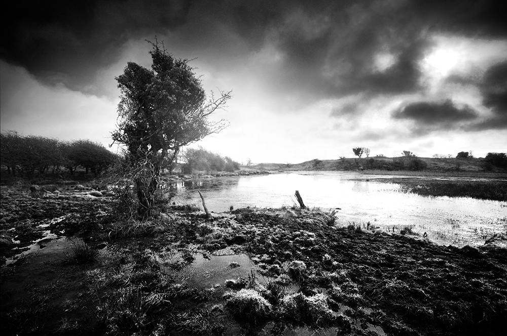
Tree beside the lochan at Man Wrap.Smashed remains of a fallen hawthorn at Man Wrap.
Sources
1. Maxwell Wood, J (1911) Witchcraft and Superstitious Record in the South-Western District of Scotland, J Maxwell & Son P. 256.
2. M’Lachlan Harper, M (1889) The Bards of Galloway, Thomas Fraser P. 16 A Legend O’ Kirkmaiden, David M’Kie.
3. Reid, R C. (1948b) ‘Dowies’, Trans Dumfriesshire Galloway Natur Hist Antiq Soc, 3rd, vol. 25, 1946-7. P. 36-8
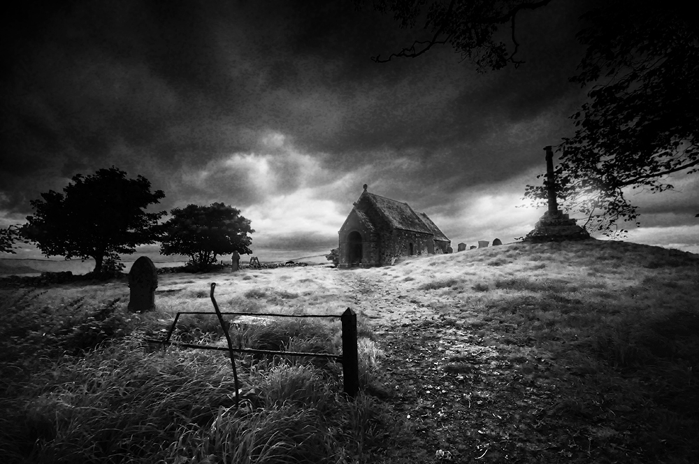
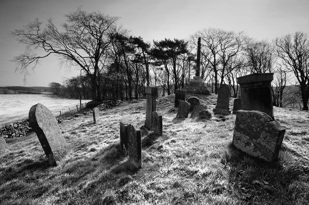
At first sight, the neo-gothic edifice of Minnigaff Parish Church looks much like many others of the period. As you walk past the neat wall and railings, into the churchyard containing well-kept Victorian tomb stones, there are few clues of what lies ahead. But the deeper you probe, the more secrets this intriguing churchyard reveals.
Standing on a promontory, formed between the waters of the Cree and Penkiln Burn, this sliver of land holds at least nearly 1000 years of history. Beyond the 19th century church are the ruins of a much older building, surrounded by tombstones and burial plots. At the southern tip of the churchyard, taking advantage of the natural topography, surrounded by steep banks, stands a motte, separated from the rest of the churchyard by a deep ditch, cut across its northern edge and would once have been surmounted by a wooden keep, surrounded by a palisade. It is of a type generally associated with the Anglo-Norman period and the area now covered by the churchyard may once have formed the bailey.
Andrew Symson describes the motte in 1684;
‘The village of Minygaff being situate at the foot of Polkill, in a low ground hard by the Church , there being an artificiall moat, which , by tradition , hath been handed down to posterity , as being at first contrived for sacrifising to Jupiter and the Heathen Gods ; and when Christianity obtained, it was used as a mercat – place for the inhabitants to meet and do business…’ 1
There seems here to be the tantalising suggestion of a pre-christian use for the site, a dim and distant memory of a place of pagan practice. Perhaps a prehistoric temple of some kind may have existed here before the motte and church. It’s not something beyond the realms of possibility, considering the number of prehistoric remains in the area.
Further upstream along the Cree, is a place still known as Wallace’s Camp, where local tradition tells a battle was fought nearby. R.C. Reid in his 1924/25 field trip account2, is of the opinion Wallace utilised an existing stronghold from antiquity, but the Canmore database describes the site as being caused by the extraction of gravel or sand from the old river terrace, rather than the remains of a camp. Reid continues, drawing from Blind Harry’s epic poem, ‘The Wallace’ in support of an assault on the Minnigaff motte castle by Wallace in 1297.
“A strenth thar was on the Wattir of Cre With in a rock, rycht stalwart wrocht off tre; A gait befor myeht no man to it wyn, Bot the consent off thaim that duelt within. On the bak side a rick and wattir was…”
The tale tells how Wallace and two companions, William Kerlie and Steven of Ireland, climbed the rock on which the impregnable castle stood, slew the sentry and took the castle. Blind Harry lived from 1440-92, writing some 170 years after Wallace’s death, claiming it to be based on a book by Wallace’s friend, Father John Blair. The book is unknown in modern times and it is thought his poem is more likely to be based on oral traditions. He is not considered to be a highly reliable source.
Reid surmises that the motte is the only site on the Cree which fits the description. However, Cruggleton Castle was also known as the ‘Black Rock of the Cree’. Tradition, if not history, states that Cruggleton had been held by the Kerlies for as long as could be remembered, until they were usurped by the deceitful William de Soulis in 1282, who handed the castle over to Edward I. With William Kerlie in his company, it seems far more likely Wallace would have retaken Cruggleton Castle for his friend. When Edward’s man John of Hoddleston at Wigtown Castle heard that Wallace was approaching, he fled ‘back to his own country’ leaving Wallace to take the castle and progress to Cruggleton. Although some mottes continued to be used until the 15th century, many fell out of use in favour of sturdier, stone built castles. So it may be the motte at Minnigaff had been abandoned by the time of Wallace’s campaign. Read more about Cruggleton Castle here.
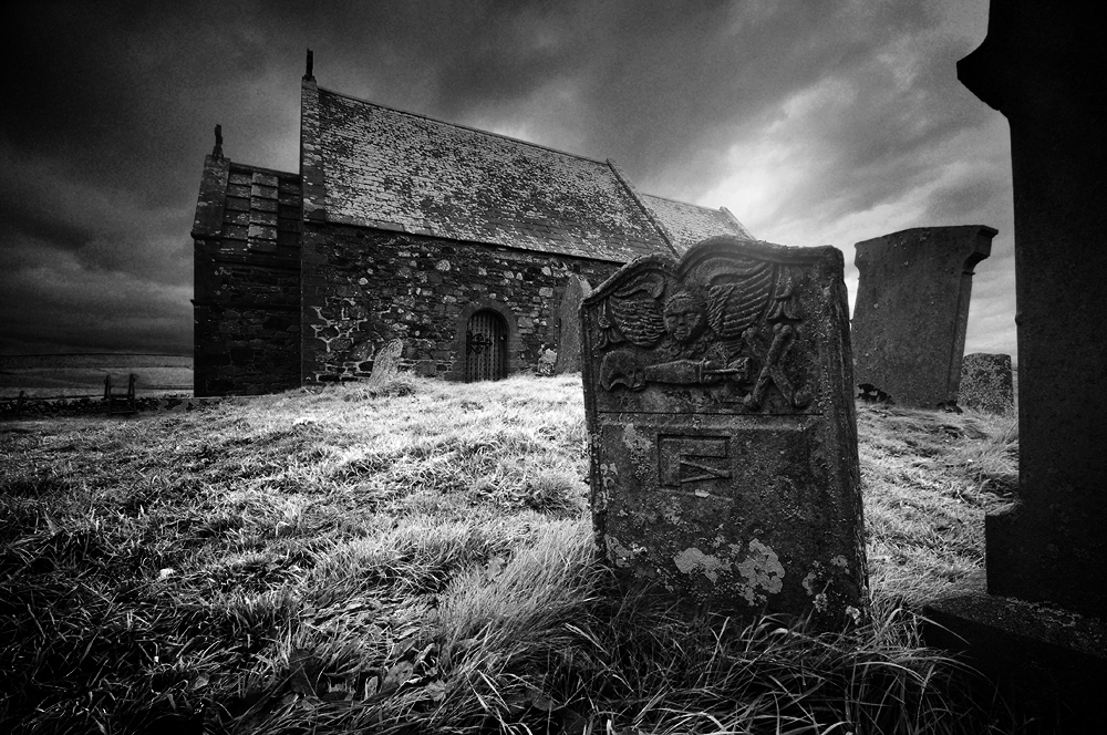
The first record of the church is in 1209, when Parson Durand attested a deed. His name appears on a witness charter by John, Bishop of Galloway3. The presence of two early cross slabs also suggests at least a tenth or eleventh century origin for the church. One slab was found in 1880 within the fabric of the old church, in use as a doorstep, the other being used as a lintel in the old market house in Minnigaff at about the same time. Both were set up in a recess in the ruined church, but have now been moved inside Minnigaff Parish Church4. The crosses may suggest the church predates the motte and there is a possibly that the complex of a church and motte together, was an early lordship centre5, perhaps founded by Fergus of Galloway.
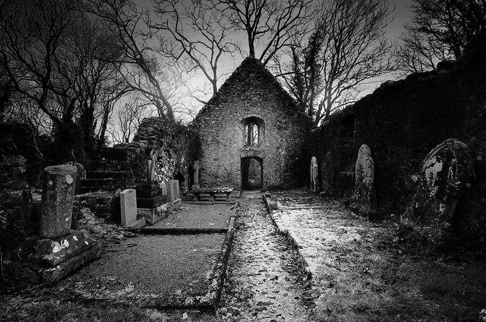
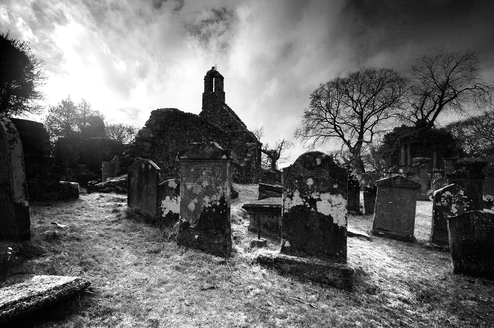
View to the east along the aisle.Winter in the kirkyard.
‘We next approached the two gable walls, ivy-covered, of the old parish church. It is more than half-a-century since worship was conducted in it, and it now contains several graves in the interior. But there are preserved within the walls a very fine Maltese cross, granite, erected on an ornamental pedestal, and of unknown date. It has been surmised that it was in honour of the four Evangelists, and certainly a human figure is sculptured on one of its sides. A cross of ruder form and older date was excavated out of the walls of this old church, and is now to be seen beside the other. A sculptured slab over the grave of an ecclesiastic, inserted in the church wall, has been removed.’6
There are clues in the surviving stonework, which tell us the old church has been renovated and remodelled a number of times. A medieval church would have stood here and the twin-light lancet windows in the east gable are probably the only surviving features of that building.
It seems likely that the medieval church was of the Premonstratensian order, as Tongland Abbey, founded as a Premonstratensian Abbey, later annexed Minngaff Church7. Very little is known of the church during this period, which seems to have undergone major reconstruction sometime after the reformation. The majority of the current church probably dates from the seventeenth century, with the east door certainly dating from the post-reformation period, as passing the altar during entering and leaving the building, was reserved solely for the priest8. A stone bearing the date 1706 sits in the east gable, which almost certainly attests to the date of a later remodelling.
‘There are in this churchyard some very old tombstones, said to be the oldest in Galloway. We noted one, dated 1416 – A. Murray – memento mori. It also contains a considerable number of monuments of elegance and taste, and the dust of a number of Galloway’s great and good repose in its precincts.’9
The Heron Monument.
On the western edge of the cemetery stands the Heron Monument, consisting of a pediment supported by two Corinthian columns, enclosed behind balustrade walls and a heavy iron gate. It is by far the most ornate tomb in the burial ground. Built in 1761 for Patrick Heron of Kirroughtree, who’s family had gained the estate through marriage in the 15th century. His father was also called Patrick and was described as a ‘ring leader’ for the Covenanters at the Battle of Bothwell Brig in 1679. He was the MP for Kirkcudbright from 1727-41 and was instrumental in diffusing tensions during the uprising of the Galloway Levellers in 1724.
Buried with him is his son, confusingly also christened Patrick and married to Elizabeth Cochrane, a cousin of James Boswell. He too was elected as the Whig MP for Kirkcudbright in 1793, eliciting support from none other than Robert Burns, who visited Kirroughtree House and devoted a number of ballads to his election10.
But mark ye! there’s trusty Kerroughtree, Whose honor was ever his law…
Another notable inhabitant is Sir William Stewart, about whose father, John Stewart, 7th Earl of Galloway, Burns was less complimentary. After a distinguished military career, including serving on the HMS Elephant with Nelson, throughout the battle of Copenhagen in 1801 and in the Peninsula War under Wellington, he retired to Cumloden near Minnigaff, where he died on 7th January 1827. He was also the MP for Wigtownshire on a couple of occasions. His casket style tomb lies close to the outer wall on the south eastern side of the old kirk.
View to the west along the aisle.The old kirk and tombs from the north.
Inside the church, above a recess is a heavily decorated memorial stone to Uchtred M’Dowall. The lion rampant crowned is the arms of the M’Dowalls. The three boars’ heads stand for Gordon. At the close of the 16th century two Patrick M’Kie’s of Larg married heiresses of those families. The heraldic stone is therefore 17th century and probably refers to Sir Patrick M’Kie of Larg, who ruined the family fortunes in the Covenanting period11.
There is another stone of the M’Kie family, depicting two raven, skewered by a single arrow. This refers back to a very well-known legend, dating from the Wars of Scottish Independence. During the early years of his campaign, Robert the Bruce was hiding out in the hills of Galloway from Edward’s troops. One night he came to the house of a widow at Craigencallie, who offered him food and shelter. She had three sons, all of who demonstrated their skills with a bow, the eldest son called M’Kie shot two ravens with a single arrow. All three sons joined his army, helping with the defeat of the English at the Battle of Raploch Moss in 1307. After Bannockburn, Robert awarded the widow with the lands between Palnure and Penkiln, which she divided between her sons, originating the families of M’Kie of Larg, Murdoch of Cumloden and M’Lurg of Kirroughtree12.
Emboldened by his success at Raploch Moss, Robert was eager to drive out any further scattered bands of English troops, who may lay in wait. Lord James Douglas had passed a village where 200 were stationed without posting a sentry, the Scots immediately rushed to the village and cut them to pieces. Although the name of the village isn’t given, it is the opinion of James G. Kinna that Minnigaff was the scene for the slaughter. He continues, a number of troops may have taken refuge in the church, as was the custom at the time, only for it to be set alight with them inside, “at a depth of two feet under the floor of the old Church there is a deep layer of bones covered with burnt and charred slates of a very rude description.” 13
Over 600 years of worship in the old church came to an end in 1836, when it was replaced by the current Parish Church. The old yew tree by the gate, thought to be about 900 years old, still grows on. The history this tree must have witnessed is thought provoking in the extreme. From its early days as a possible residence of the Lords of Galloway, through the centuries of catholic worship, the turbulence of the reformation and the covenanting days, through the Wars of Independence and the War of the Three Kingdoms.
Maybe it was the church that arrived here first, to Christianise a formerly pagan place of worship and the motte and lordship centre followed. If so, that would mean this had been a significant place for possibly thousands of years. And with the possibility that some of Scotland’s most heroic national figures may have passed under its shade, this tree has witnessed so much history and maybe, many secrets yet to be uncovered.
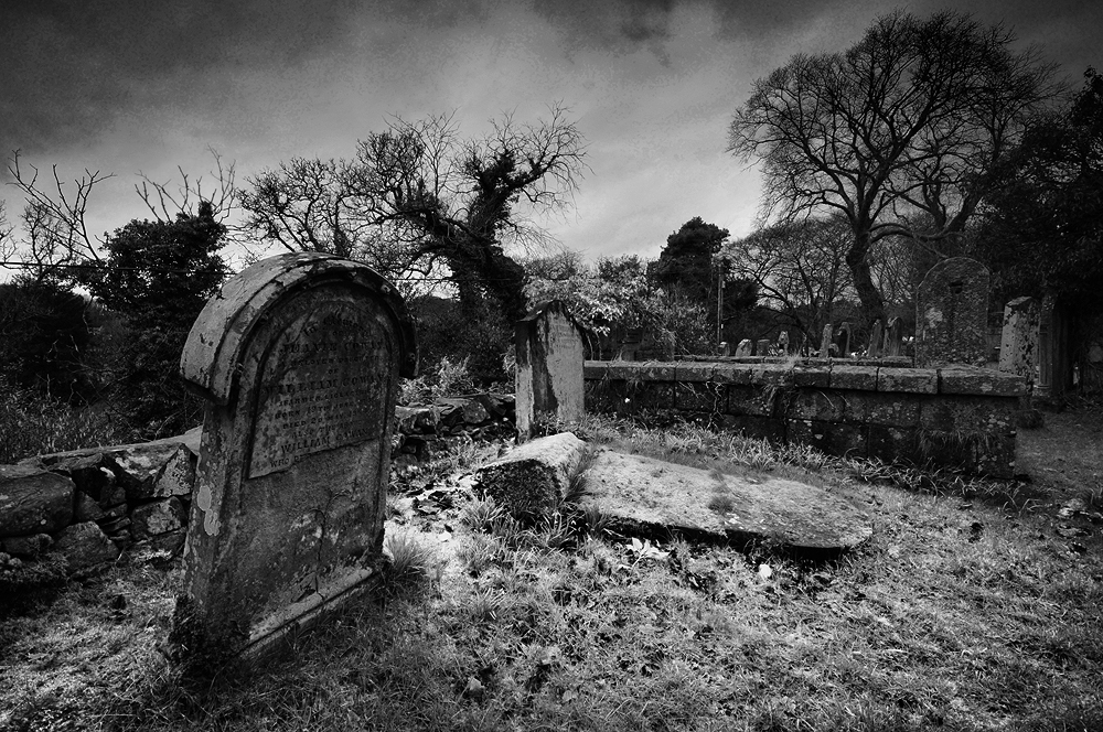
Tombs overgrown with the patina of age.
References 1. A Large Description Of Galloway – Andrew Symson 1684 (pub. 1823). 2. DGNHAS Transactions and Journal of Proceedings 1924-25 Third Series Volume 12 – R.C. Reid. 3. History of the Parish of Minnigaff – James G. Kinna (1904). 4. Canmore: canmore.org.uk/site/319607/minnigaff-old-parish-church-burial-ground-cross-slabs 5. Historic Environment Scotland: portal.historicenvironment.scot/designation/SM11054 6. DGNHAS Transactions and Journal of Proceedings 1891-92, Second Series Volume 8 – Author not given. 7. Kinna (1904) 8. Ibid. 9. Rambles in Galloway – Malcolm M’Lachlan Harper (1876). 10. Thank you to Andrew Wilson for bringing this to my attention. 11. R.C.Reid (1924-25). 12. Ibid. 13. Kinna (1904)
High on the sea lashed cliffs a little south of Portpatrick, perches the ruinous husk of Dunskey Castle. The epitome of a ruined castle that could grace the cover of any book of Scottish ghost stories and with a history to match. This rocky promontory has been a fortified stronghold way back into history, maybe as far back as the Iron Age and the scene of many a dark deed.
According to the Book of Leinster, the former name for Portpatrick was Port Rig (Portree), meaning the Port of the King and a strong candidate for the location of Rerigonium, the lost royal town of the Novantae named by Ptolemy in his 2nd century map of Britain.
During the medieval period, a castle has stood on this spot since at least the 14th century, built by the Adairs of Kinhilt. This castle was attacked and burnt in 1489 by McCulloch of Myrton in retaliation for the murder of Dionysius of Hamilton by William Adair of Dunskey.
The current tower house was rebuilt by the Adairs in 1510, which they inhabited until 1620, when it was sold to Hugh Montgomery, 1st Viscount Montgomery. He extended the castle before it passed to the Blair family in 1648, but by the end of the 17th Century it had been abandoned and was already a ruin.
In keeping with the castle’s sinister appearance, tales of dark deeds carried out within its walls abound. The abbot of Soulseat Abbey was imprisoned and tortured in the castle to force him to sign away the abbey lands. The castle is said to also be the home of a brownie known as the Hairy Man.
A story, said to date from the 14th century tells of how the castle was occupied by the cruel Walter de Curry, who took offence to an outspoken Irish piper that he had taken prisoner and forced into service as a minstrel and jester. The piper was thrown into the castle dungeons, where he was left to starve, but found his way into a secret passageway that lead to a cave on the shore. The cliffs here are steep and high, preventing his escape and he died a slow and lingering death. His ghost is said to still march back and forth along the passage from where the skirl of his pipes can be heard above the crashing of the waves.
Another ghost, that of a nurse maid who accidentally dropped a baby from one of the windows onto the rocks below, is said to also haunt this place. Consumed by guilt, she followed her charge and threw herself from the cliffs.
If you are going to encounter a spectre or a brownie, these crumbling cliff top ruins would be as good a place as any. Is that the wind or the sound of pipes I can hear coming from below?
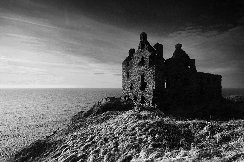
Final daylight on Dunskey Castle, before night takes hold once more.Dunskey Castle perched on its cliff-top location.
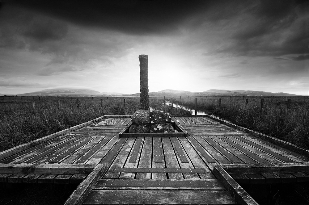
The Martyr’s Stake memorial on the site of old Wigtown Harbour.
The 17th century was a dangerous time to be alive, with a multitude of ways in which your life could be brought to a sharp and unpleasant end. If disease or starvation didn’t get you, you could be hung for what today would be judged as the slightest misdemeanour. If your neighbour’s cow stopped giving milk or their crops failed and you weren’t on the best of terms, you might be outed as a witch who had placed a curse on them.
In south western Scotland in particular, a religious battle raged throughout most of the 17th century between the Episcopalian state religion and the Presbyterian movement of the Covenanters, named after the National Covenant, signed throughout lowland Scotland in 1638.
When King Charles I attempted to impose the Book of Common Prayer on Scotland in 1637, it was violently rejected by congregations who saw God as the head of their church and not the king. The rejection of Charles’ liturgy and the signing of the Covenant contributed towards his downfall as he stumbled towards the outbreak of the War of the Three Kingdoms. The Covenanter Army fought against Charles, signing the Solemn League and Covenant with the English Parliamentarians in 1643 and it was they who captured Charles in Scotland and handed him over to Cromwell, with fatal consequences.
The Covenanters were appalled by Charles’ execution and supported the restoration of Charles II, insisting that he signed the covenant first and crowned him King of Scotland in 1651. Cromwell turned on Scotland and forced a temporary union under the Commonwealth.
Upon the restoration of Charles II in 1660, he reneged on the Covenant, declared them outlaws and restored the Episcopacy. This was the beginning of what came to be known as the Killing Time, which lasted until James II was unseated in 1688 by the ‘Glorious Revolution’.
Presbyterian ministers were turned out of their churches and took to performing their sermons in secret, hidden among the moors and glens. Known as Conventicles, these open air meetings were declared a capital offence for which attendees could be shot on the spot. Even carrying a bible or just being outside in the wrong place at the wrong time was enough to order execution without trial. Many atrocities were committed in south west Scotland, which are now commemorated with lonely graves and memorials among the hills and moors.
In 1685, as the Killing Time reached its worst point, three women were dragged from the surrounding countryside to the tollbooth in Wigtown. Margaret McLachlan (about 63) of Drumjargon near Kirkinner, Margaret Wilson (accounts of her age vary from 18 to 23) and her younger sister Agnes (13), both of Glenvernoch near Newton Stewart, were all condemned to death by drowning for attending conventicles and being present at the rebellions of Bothwell Bridge and Airds Moss (despite this being a virtual impossibility).
Gilbert Wilson paid £100 for the release of his younger daughter Agnes, which all but ruined him. A pardon for the remaining two condemned women was issued in Edinburgh on 30th April 1685, but strangely was not enacted. It seems that Robert Grierson of Lagg (forever remembered as ‘Cruel Lagg’) chose to ignore the pardon and push forward the executions.
On 11th May 1685 both women were lead out to the harbour of Wigtown and tied to stakes below the high water mark. Margaret McLachlan was placed further out with the intention that she would drown first, the sight of which may prompt the younger Margaret to take the Oath of Abjuration. The sight of McLachlan drowning just seemed to strengthen Margaret Wilson’s resolve and she sang psalms and prayed while the waters worked their way up towards her head.
At the point where the waters had nearly overwhelmed her, the attendant soldiers lifted her free a little and asked if she would now pray for the king? It is said that Margaret answered, “God save him if He will, for it is his salvation I desire.”
Her friends gathered on the shore shouted that she had said the oath, but Grierson of Lagg insisted that this was not enough and that the full Oath of Abjuration should be said. She refused and was thrust back into the water, a soldier holding her head under with his halberd saying, “then tak another drink hinny.” She was held under until she died.
The remains of Margaret McLachlan and Margaret Wilson now lie in Wigtown Churchyard, along with the bodies of three men, William Johnstone, John Milroy and George Walker, hung later the same year, probably on Gallow Hill at Bladnoch.
Of those that took part in their deaths, the soldier who held the women under with his halberd was said to be afflicted with an unquenchable thirst for the rest of his life.
Grierson of Lagg was responsible for many more atrocities during the Killing Time. He seemed to take a cruel pleasure in the over-zealous application of his duties. It is said that he went to hell before he died. His spit could corrode whatever it landed on like acid and if he placed his feet in water, it would boil. Upon his death, a carriage surrounded by a thunder storm came to take his soul to hell. A huge raven followed his cortege to his burial and the horses that pulled his coffin died when they reached the cemetery gates.
In the early 19th century, the course of the river Bladnoch was altered and the harbour moved. All that remains now is a stretch of quiet marshland with a lonely memorial and this collection of gravestones nearby in Wigtown Churchyard.
Pushing back the heavy Victorian iron gate at the roadside, which seems to resist at first, a tree-lined track leads towards the church. In summer it is a pleasant walk, sunlight filters through the leaves and birds sing overhead. Winter is a very different proposition, when the wind whips the bare tree-tops, their trunks creaking and groaning warnings of what lies ahead.
It is late afternoon and the daylight hours are heading towards their end. On days like today, daylight is nothing more than varying shades of darkness. Colours are barely perceptible as anything other than hues of grey and the low clouds mingled with the land. There is no birdsong today, just the sound of your own footsteps on the path and the wind in the trees.
On reaching the top of the avenue, the small church comes in to view behind another iron gate. This one scrapes along the wet ground, catching the damp remains of this year’s fallen leaves. The entrance is guarded by a high cross on a mound, with a suggestion it is more to keep something in, than the curious out. At first glance the significance of this unassuming, isolated little church isn’t obvious, but it eventually becomes apparent just how deep the history of this place runs.
The current church building dates from the 1890’s and was rebuilt as a mausoleum for the MacTaggarts of Ardwell on the footprint of a much earlier medieval building, the site possibly dating from the 5th century. The main focus of attention here however is preserved in the porch. Encased behind glass are three of the earliest inscribed Christian gravestones in Scotland, probably dating from the 6th century. Only the Latinus Stone in Whithorn is older. They remained in place until the 1850s, when the two taller stones were used as the churchyard gateposts and the smaller of the three disappeared, for some years known as the ‘lost stone of Kirkmadrine’ until its rediscovery in 1916.
Prehistoric standing stones and well-springs nearby suggest this has been a place of special significance for thousands of years. Perhaps the carved stones, marking the graves of the priests Viventius, Mavorius and Florentius and bearing the Chi-Rho monogram of emperor Constantine, are re-used standing stones. The smaller stone bears the Latin script, ‘INITIUM ET FINIS’, the beginning and the end. The presence of these stones suggests there was almost certainly a very early monastic site here, with a possibility this was the location of St Ninian’s Candida Casa, rather than Whithorn, where no early monastic remains have yet been found. Later in the early medieval period, it may have served as a staging post between Celtic Ireland and Anglian Whithorn and it survived into the Gall-Ghàidheil period and beyond.
INITIUM ET FINIS. Whatever brought those early people to this special place is still here. The long history of worship on this patch of earth has pushed its residue deep into the landscape. Something ancient, beyond comprehension, a deep, lingering bass note of time, that will still be here in millennia to come. Some visitors claim to experience a feeling of serenity, or some of being watched, there are reports of unexplained figures seen reflected in the glass of the porch. It is a deeply evocative place that invites a reaction from the visitor, depending on when you visit and your own state of mind.
Kirkmadrine sits in quiet isolation on it’s little hilltop, with views over Luce Bay to the Machars. A lovely place to spend a summer’s afternoon, but today is not for lingering. Highlights are fading to grey and the shadows deepening as the sun draws close to the horizon. Your senses heighten as night creeps across the land, filling its hollows with monochrome. The damp air feels charged with atmospheric intensity as the blackness looms up around you. Figures seem to fill the shadows in your peripheral vision, then vanish. You feel drawn towards the gate and before any conscious decision has been made, your feet are leading you back down the path away from the church at a pace. Maybe best not to look back!